Sites and Monuments Record · Ireland
Castle - motte and bailey
Knockroe (Rathvilly By.), County Carlow, Ireland
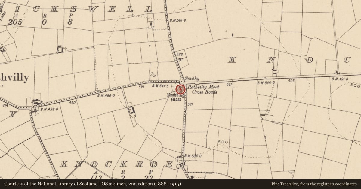
The record
- Townland
- Knockroe (Rathvilly By.)
- County
- Carlow
- Country
- Ireland
- First-edition OS map
- Rathvilly Moat
- Latest-edition OS map
- Rathvilly Moat
- Coordinates
- 52.88046, -6.67808
- SMR number
- CW004-014----
Slide toward Today to fade the historical sheet and see the modern map underneath.
David Rumsey Map Collection, Stanford LibrariesDavid Rumsey Map Collection, Stanford LibrariesDavid Rumsey Map Collection, Stanford LibrariesDavid Rumsey Map Collection, Stanford Libraries
4 historical maps cover this location, the earliest the 1790 map "Composite: Ireland." (David Rumsey Map Collection, Stanford Libraries).
Historical maps covering this location
- 1790 · Composite: Ireland. (David Rumsey Map Collection, Stanford Libraries)
- 1799 · Ireland. (David Rumsey Map Collection, Stanford Libraries)
- 1830 · V.3:11-15:XV. Britisches Reich. C. Kon: Ireland. a. Prov: Leinster. Counties: 1-12 (David Rumsey Map Collection, Stanford Libraries)
- 1891 · Ireland 16 (David Rumsey Map Collection, Stanford Libraries)
This record in the National Monuments Service's Historic Environment Viewer ↗
The National Monuments Service's description
National Monument No. 603. Modified, steep-sided mound (present H 4.5-5m, base diam. 23.7m, summit diam. 9.5m) on summit of broad flat-topped hill in commanding position. Summit of motte has been lowered and sides cut back 1m above base from N-E-SE to form slight platform. A possible bailey, visible as a cropmark on Google Earth (imagery date 14 July 2018) has been identified by Simon Dowling. This cropmark of a fosse (Wth c. 1.5m)forms a roughly semi-circular area S-SW-W of the motte. It is visible c. 75m to the W, c. 85m to the SW and c. 57m S of the motte.
See attached:
CW004-014----_01 Google Earth image (imagery date 14 July 2018)
CW004-014----_01 Google Earth image (imagery date 14 July 2018) with bailey highlighted
Compiled by: Anna Brindley, Annaba Kilfeather and Jean Farrelly
Date of upload/revision: 25 February 2020
The above description is derived from the published 'Archaeological Inventory of County Carlow' (Dublin: Stationery Office, 1993). In certain instances the entries have been revised and updated in the light of recent research.
Nearby in the register
- Ogham stoneunder 1 mi
- Ritual site - holy wellunder 1 mi
- Churchunder 1 mi
- Graveyardunder 1 mi
Other entries of the same register within about three miles of this one, by straight line.