Sites and Monuments Record · Ireland
Souterrain
Bawnlahan (Carbery West (E.D.) By., Castlehaven Par.), County Cork, Ireland
The record
- Townland
- Bawnlahan (Carbery West (E.D.) By., Castlehaven Par.)
- County
- Cork
- Country
- Ireland
- First-edition OS map
- NULL
- Latest-edition OS map
- Not indicated
- Coordinates
- 51.50080, -9.25771
- SMR number
- CO150-077----
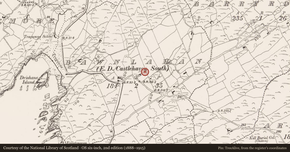
Slide toward Today to fade the historical sheet and see the modern map underneath.
David Rumsey Map Collection, Stanford LibrariesDavid Rumsey Map Collection, Stanford LibrariesDavid Rumsey Map Collection, Stanford LibrariesDavid Rumsey Map Collection, Stanford Libraries
4 historical maps cover this location, the earliest the 1841 map "Ireland." (David Rumsey Map Collection, Stanford Libraries).
Historical maps covering this location
- 1841 · Ireland. (David Rumsey Map Collection, Stanford Libraries)
- 1866 · Ireland. (David Rumsey Map Collection, Stanford Libraries)
- 1868 · 4. Ireland. (David Rumsey Map Collection, Stanford Libraries)
- 1882 · Ireland (southern half). (David Rumsey Map Collection, Stanford Libraries)
This record in the National Monuments Service's Historic Environment Viewer ↗
The National Monuments Service's description
On level ground, on a break in a W-facing slope, overlooking Tragumna Bay. This souterrain was discovered in 2001 when a number of roof lintels were displaced during topsoil removal. An opening (c. 2.4m E-W; 1.7m N-S) gave access to an irregular chamber (2.6m NNW-SSE; 2.2m NNE-SSW; H 1.25m), mostly earth-cut but partially rock-cut on its E side. The chamber was roofed with lintels but only one (L 1.6m; Wth 0.65m) of these, which is cracked, remains in situ at the SSE side of the chamber. A second lintel (L 1.1m; Wth 0.4m; T 0.15m) lies on top of fallen earth on the floor of the chamber. A third stone (L 1.35m; Wth 0.55m; T 0.2m), at the NNW end of chamber, is raised slightly above the chamber floor and rests on a number of thin courses of stones. It appears to be in situ but may not have been a lintel. Also at the NNW end of the chamber, 0.5m behind the former stone and largely blocked by it is an opening roofed by a large lintel (L 1.5m). This opening is at a much lower level than the roof of the chamber and extends back for at least 0.85m, where fill is visible suggesting a previous collapse. At the SSE side of the chamber, where the lintel remains in situ, are two creepways. The first earth-cut creepway (Wth 0.4m) at SE leads into a passage which appears to be blocked by fill from a previous collapse. Access to this creepway is partially blocked by fallen earth. There is a possible second creepway at S, but earth from the walling of the chamber has collapsed and blocked it. A third creepway (Wth 0.4m; H c. 0.5m) exists at the W side of the chamber, leading into a linear earth-cut passage (L 2.8m; Wth 0.8m; H 0.89m) with gently sloping sides and a rounded top. The passage slopes down gently. After 2.8m, the passage (H 0.7m) continues for a further 2m and is roofed by four large lintels. The lintels are supported on the S side by the earth-cut wall and on the N side by stone walling with the most easterly lintel supported at its NE corner by one upright stone. This upright stone sits on a ledge of uncut earth and is separated from the lintel overhead by two pad-stones. Beyond the upright support-stone, the floor of the passage rises sharply forming a scarp and then slopes more gradually upwards to meet the roof of the passage. This may be the remains of the original entrance to the souterrain. At the S side of the passage, where the first lintel exists, is a creepway into a circular or oval rock-cut chamber. There is a drop down into this chamber and at the far end of the chamber is a creepway leading into another chamber. These chambers could not be inspected for safety reasons.
The above description is derived from 'The Archaeological Inventory of County Cork. Volume 5' (Dublin: Stationery Office, 2009).
Date of upload: 22 December 2009
Nearby in the register
- Ringfort - rathunder 1 mi
- Souterrainunder 1 mi
- Burial groundunder 1 mi
- Burial groundunder 1 mi
Other entries of the same register within about three miles of this one, by straight line.