Sites and Monuments Record · Ireland
Mine - copper
Skeagh (Carbery West (W.D) By.), County Cork, Ireland
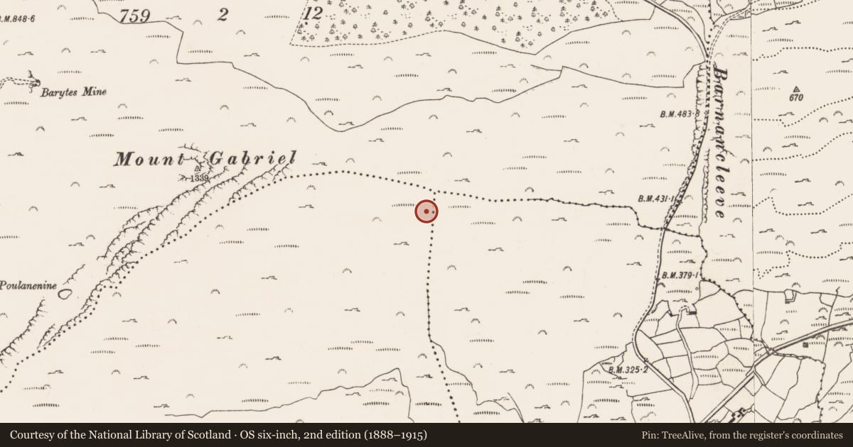
The record
- Townland
- Skeagh (Carbery West (W.D) By.)
- County
- Cork
- Country
- Ireland
- First-edition OS map
- Not indicated
- Latest-edition OS map
- Not indicated
- Coordinates
- 51.55602, -9.53484
- SMR number
- CO139-026009-
Slide toward Today to fade the historical sheet and see the modern map underneath.
David Rumsey Map Collection, Stanford LibrariesDavid Rumsey Map Collection, Stanford LibrariesDavid Rumsey Map Collection, Stanford LibrariesDavid Rumsey Map Collection, Stanford Libraries
4 historical maps cover this location, the earliest the 1790 map "Composite: Ireland." (David Rumsey Map Collection, Stanford Libraries).
Historical maps covering this location
- 1790 · Composite: Ireland. (David Rumsey Map Collection, Stanford Libraries)
- 1868 · 4. Ireland. (David Rumsey Map Collection, Stanford Libraries)
- 1882 · Ireland (southern half). (David Rumsey Map Collection, Stanford Libraries)
- 1891 · Ireland 16 (David Rumsey Map Collection, Stanford Libraries)
This record in the National Monuments Service's Historic Environment Viewer ↗
The National Monuments Service's description
17.4m S of another mine (CO139-026008-), on the same grey-green sandstone sequence. First recorded by Jackson (1968), it is one of 31 copper mines belonging to Mount Gabriel Prehistoric mining complex (CO139-026001-, a National Monument in State Care). On inspection in 1984 this suspect working consisted in a shallow opening (Wth c. 1m; H 0.1m) driven into a low E-facing outcrop. This may be a small infilled mine, however, this was not confirmed as no spoil dumps or stone mauls were associated with the site. (O'Brien 1987, and 1994, 339 and 342: mine 23).
This is a National Monument in State Care.
The above description is derived from the published 'Archaeological Inventory of County Cork. Volume 1: West Cork' (Dublin: Stationery Office, 1992) and William O’Brien’s monograph ‘Mount Gabriel, Bronze Age mining in Ireland’ (Galway: Galway University Press, 1994).
Image attached:
CO139-026009-_01: Site of mines CO139-026009- and CO139-026008-
Date of upload/revision: 14 January 2009
References
O'Brien, W. 1994 Mount Gabriel: Bronze Age mining in Ireland. Galway University Press.
O'Brien, W. 1987 Primitive copper mining in south-west Ireland, 3 vols. Unpublished Ph.D. thesis. University College, Cork.
Jackson, J.S. 1968 Bronze Age copper mines on Mount Gabriel, west County Cork, Ireland. Arch. Austriaca 43, 92-103.
Nearby in the register
- Mine - copperunder 1 mi
- Mine - copperunder 1 mi
- Mine - copperunder 1 mi
- Mine - copperunder 1 mi
Other entries of the same register within about three miles of this one, by straight line.