Sites and Monuments Record · Ireland
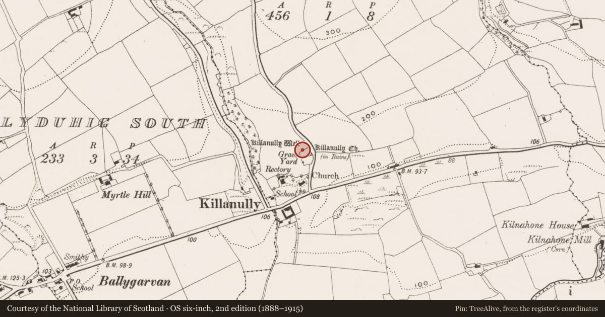
Graveyard
Killanully, County Cork, Ireland
The record
- Townland
- Killanully
- County
- Cork
- Country
- Ireland
- First-edition OS map
- NULL
- Latest-edition OS map
- Grave Yd (1933)
- Coordinates
- 51.82727, -8.45210
- SMR number
- CO086-045001-
Slide toward Today to fade the historical sheet and see the modern map underneath.
David Rumsey Map Collection, Stanford LibrariesDavid Rumsey Map Collection, Stanford LibrariesDavid Rumsey Map Collection, Stanford LibrariesDavid Rumsey Map Collection, Stanford Libraries
4 historical maps cover this location, the earliest the 1790 map "Composite: Ireland." (David Rumsey Map Collection, Stanford Libraries).
Historical maps covering this location
- 1790 · Composite: Ireland. (David Rumsey Map Collection, Stanford Libraries)
- 1882 · Ireland (southern half). (David Rumsey Map Collection, Stanford Libraries)
- 1883 · Ireland 3. (David Rumsey Map Collection, Stanford Libraries)
- 1891 · Ireland 16 (David Rumsey Map Collection, Stanford Libraries)
This record in the National Monuments Service's Historic Environment Viewer ↗
The National Monuments Service's description
On W side of road; roughly rectangular graveyard (c. 100m NW-SE; c. 40m E-W) bounded by stone walls; E side curves to respect road. Extended to N in 19th century with recent extension to W. N half still in use; S half, heavily overgrown, contains ruins of Killanully parish church (CO086-04502-) at E edge overlooking road. Ground slopes steeply away from S wall of church. Coleman (1910-12, 252) notes 'about forty headstones here', earliest inscribed headstones date to 1750s; immediately outside N wall of church family vault dated 1796. Just outside enclosing wall to E, headstone of Thomas Busteed dated 1756. At SW corner, built into S-facing slope, rectangular (3.6m E-W; 4.2m N-S) 2-storey watch house; roofless and missing gables; ground floor door in E wall.
The above description is derived from the published 'Archaeological Inventory of County Cork. Volume 2: East and South Cork' (Dublin: Stationery Office, 1994). In certain instances the entries have been revised and updated in the light of recent research.
Date of upload/revision: 14 January 2009
Nearby in the register
- Churchunder 1 mi
- Ritual site - holy wellunder 1 mi
- Enclosureunder 1 mi
- Ringfort - rathunder 1 mi
Other entries of the same register within about three miles of this one, by straight line.