Sites and Monuments Record · Ireland
Church
Churchtown (Barrymore By.), County Cork, Ireland
The record
- Townland
- Churchtown (Barrymore By.)
- County
- Cork
- Country
- Ireland
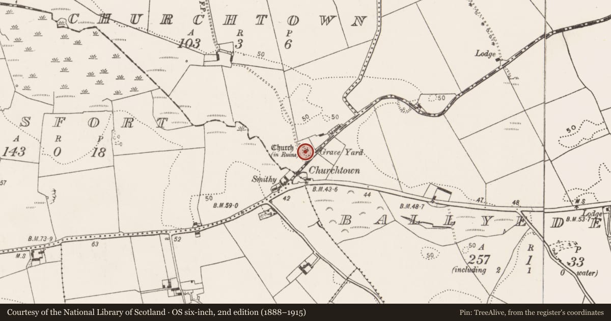
- Latest-edition OS map
- Church (in Ruins) (1933)
- Coordinates
- 51.91618, -8.12303
- SMR number
- CO076-030002-
Slide toward Today to fade the historical sheet and see the modern map underneath.
David Rumsey Map Collection, Stanford LibrariesDavid Rumsey Map Collection, Stanford LibrariesDavid Rumsey Map Collection, Stanford LibrariesDavid Rumsey Map Collection, Stanford Libraries
4 historical maps cover this location, the earliest the 1790 map "Composite: Ireland." (David Rumsey Map Collection, Stanford Libraries).
Historical maps covering this location
- 1790 · Composite: Ireland. (David Rumsey Map Collection, Stanford Libraries)
- 1865 · Ireland, (South) Sheet. (David Rumsey Map Collection, Stanford Libraries)
- 1882 · Ireland (southern half). (David Rumsey Map Collection, Stanford Libraries)
- 1891 · Ireland 16 (David Rumsey Map Collection, Stanford Libraries)
This record in the National Monuments Service's Historic Environment Viewer ↗
The National Monuments Service's description
At centre of graveyard (CO076-03001-), ivy-clad ruin of rectangular church (15.6m E-W; 7.4m N-S). E gable and S wall stand to full height, but N wall broken at window position near NE corner and W gable missing upper portion. Interior overgrown and long used for burial with headstone dating to 1775 (Coleman 1913-16b, 235). Entered by door with pointed arch and deep outer chamfer to surround, near W end of S wall. Pointed, two-light window in centre of E wall, light rebated along outside and inside edge; segmental arch over embrasure. Aumbry and piscina near E end of S wall; piscina in shallow recess with pointed arch, quatrefoil bowl cut in base. Immediately to W of piscina, window with single pointed light and further to W second window, very badly damaged. Base of attic window survives on W gable. Late medieval parish church of Inchinabracky (Brady 1863, vol. 2, 233-5).
The above description is derived from the published 'Archaeological Inventory of County Cork. Volume 2: East and South Cork' (Dublin: Stationery Office, 1994). In certain instances the entries have been revised and updated in the light of recent research.
Date of upload/revision: 14 January 2009
Nearby in the register
- Graveyardunder 1 mi
- Fulacht fiaunder 1 mi
- Enclosureunder 1 mi
- Moundunder 1 mi
Other entries of the same register within about three miles of this one, by straight line.