Sites and Monuments Record · Ireland
Graveyard
Churchtown (Barrymore By.), County Cork, Ireland
The record
- Townland
- Churchtown (Barrymore By.)
- County
- Cork
- Country
- Ireland
- First-edition OS map
- NULL
- Latest-edition OS map
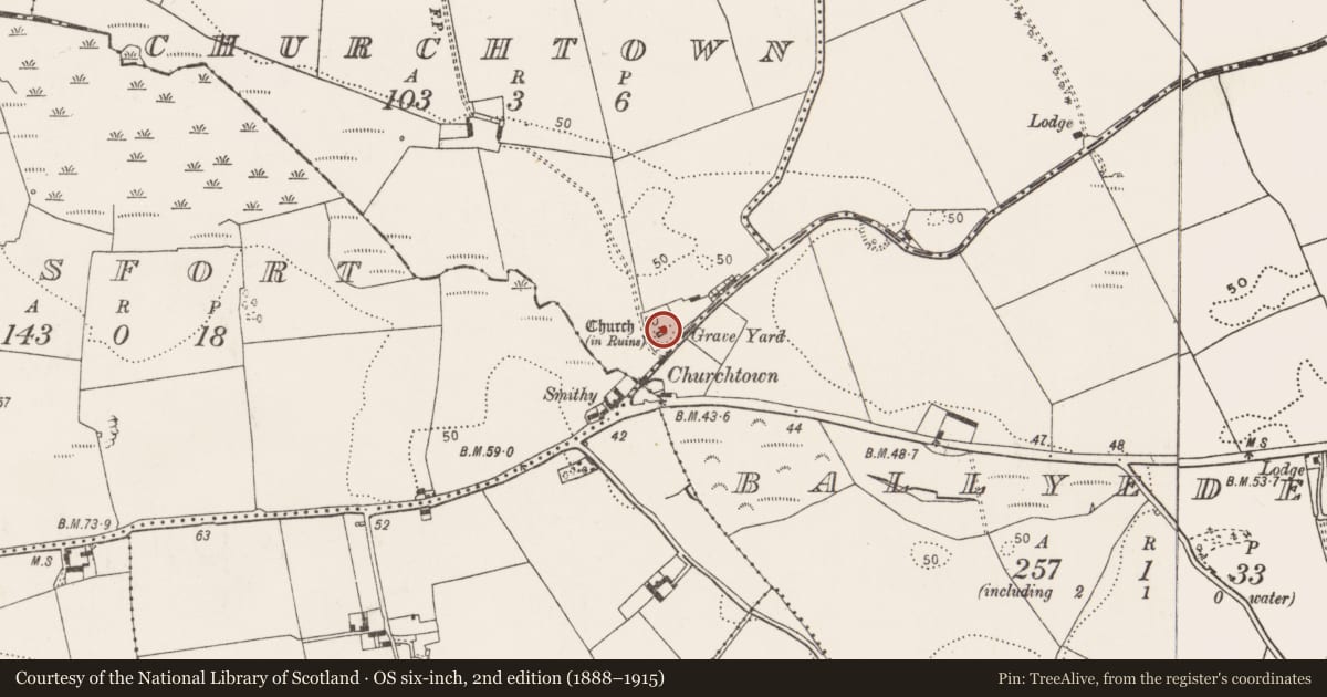
- Grave Yard (1933)
- Coordinates
- 51.91624, -8.12298
- SMR number
- CO076-030001-
Slide toward Today to fade the historical sheet and see the modern map underneath.
David Rumsey Map Collection, Stanford LibrariesDavid Rumsey Map Collection, Stanford LibrariesDavid Rumsey Map Collection, Stanford LibrariesDavid Rumsey Map Collection, Stanford Libraries
4 historical maps cover this location, the earliest the 1790 map "Composite: Ireland." (David Rumsey Map Collection, Stanford Libraries).
Historical maps covering this location
- 1790 · Composite: Ireland. (David Rumsey Map Collection, Stanford Libraries)
- 1865 · Ireland, (South) Sheet. (David Rumsey Map Collection, Stanford Libraries)
- 1882 · Ireland (southern half). (David Rumsey Map Collection, Stanford Libraries)
- 1891 · Ireland 16 (David Rumsey Map Collection, Stanford Libraries)
This record in the National Monuments Service's Historic Environment Viewer ↗
The National Monuments Service's description
On N side of road; roughly rectangular graveyard (c. 50m N-S; c. 40m E-W) with ruins of parish church of Inchinabracky (CO076-03002-) at centre; in occasional use. Coleman (1913-16b) notes 'about fifty headstones here, besides two table-tombs', the earliest dating from 1740s; O'Shea (1988, 80) notes headstone, dated 1749, as containing 'a richness of new decorative motifs, notably the lozenge-shaped panel containing the inscription'; second 1749 headstone described as 'magnificent specimen' (ibid., 79), range of motifs include two Eagles, Chain, Hourglass and Set-Square (probably indicating membership of Masonic Order). New C of I church built across road to SE in 1839 (Brady 1863, vol. 2, 235), but not shown on 1902 OS 6-inch map; site now occupied by manufacturing premises.
The above description is derived from the published 'Archaeological Inventory of County Cork. Volume 2: East and South Cork' (Dublin: Stationery Office, 1994). In certain instances the entries have been revised and updated in the light of recent research.
Date of upload/revision: 14 January 2009
Nearby in the register
- Churchunder 1 mi
- Fulacht fiaunder 1 mi
- Enclosureunder 1 mi
- Moundunder 1 mi
Other entries of the same register within about three miles of this one, by straight line.