Sites and Monuments Record · Ireland
Country house
Inchigaggin (Cork By.), County Cork, Ireland
The record
- Townland
- Inchigaggin (Cork By.)
- County
- Cork
- Country
- Ireland
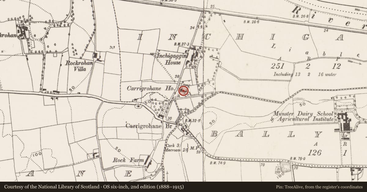
- Latest-edition OS map
- Carrigrohane Ho (1939)
- Coordinates
- 51.89212, -8.53981
- SMR number
- CO073-085----
Slide toward Today to fade the historical sheet and see the modern map underneath.
David Rumsey Map Collection, Stanford LibrariesDavid Rumsey Map Collection, Stanford LibrariesDavid Rumsey Map Collection, Stanford LibrariesDavid Rumsey Map Collection, Stanford Libraries
4 historical maps cover this location, the earliest the 1790 map "Composite: Ireland." (David Rumsey Map Collection, Stanford Libraries).
Historical maps covering this location
- 1790 · Composite: Ireland. (David Rumsey Map Collection, Stanford Libraries)
- 1882 · Ireland (southern half). (David Rumsey Map Collection, Stanford Libraries)
- 1883 · Ireland 3. (David Rumsey Map Collection, Stanford Libraries)
- 1891 · Ireland 16 (David Rumsey Map Collection, Stanford Libraries)
This record in the National Monuments Service's Historic Environment Viewer ↗
The National Monuments Service's description
Early 18th century 2-storey house, on low-lying ground S of River Lee. Entrance front (W) of 3 bays; central square-headed doorway; narrow sash windows with shallow reveals. Garden front (S) 4 bays deep; 2-storey, 3-bay hipped roof addition attached to SE corner; stairway addition obscures E front. W, E and S elevations weather-slated at 1st floor level. Sprocketed hipped roof with carved limestone cornice to E, S and W; chimney off-centre to E; to N, exposed gable with 3 narrow attic windows under apices of E and W roofs; 2 chimneys just inside apices and cross wall between them from top of gable. Cobbled yard to E enclosed by 1-storey outbuildings; S range built with ashlar blocks. Local tradition of well close to house; circular pond marked 'Fish Pond' on 1842 OS 6-inch map fed by water channel to S of house may mark location.
The above description is derived from the published 'Archaeological Inventory of County Cork. Volume 2: East and South Cork' (Dublin: Stationery Office, 1994). In certain instances the entries have been revised and updated in the light of recent research.
Date of upload/revision: 14 January 2009
Nearby in the register
- Country houseunder 1 mi
- Earthworkunder 1 mi
- Country houseunder 1 mi
- Country houseunder 1 mi
Other entries of the same register within about three miles of this one, by straight line.