Sites and Monuments Record · Ireland
Cave
Carrigane (Muskerry East By.), County Cork, Ireland
The record
- Townland
- Carrigane (Muskerry East By.)
- County
- Cork
- Country
- Ireland
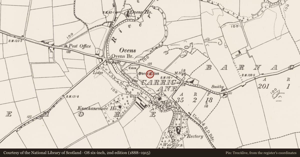
- Latest-edition OS map
- Ovens Caves (1939)
- Coordinates
- 51.87952, -8.65155
- SMR number
- CO073-071----
Slide toward Today to fade the historical sheet and see the modern map underneath.
David Rumsey Map Collection, Stanford LibrariesDavid Rumsey Map Collection, Stanford LibrariesDavid Rumsey Map Collection, Stanford LibrariesDavid Rumsey Map Collection, Stanford Libraries
4 historical maps cover this location, the earliest the 1790 map "Composite: Ireland." (David Rumsey Map Collection, Stanford Libraries).
Historical maps covering this location
- 1790 · Composite: Ireland. (David Rumsey Map Collection, Stanford Libraries)
- 1882 · Ireland (southern half). (David Rumsey Map Collection, Stanford Libraries)
- 1883 · Ireland 3. (David Rumsey Map Collection, Stanford Libraries)
- 1891 · Ireland 16 (David Rumsey Map Collection, Stanford Libraries)
This record in the National Monuments Service's Historic Environment Viewer ↗
The National Monuments Service's description
Located c. 4km W of Ballincollig; entrance on S side of limestone quarry. Investigated by Caulfield (1866, 295) who found bones of wolf, boar and 'some human remains' embedded in stalactite floor of passage. In main chamber, at a depth of one foot under the surface, he found 'bones mixed with charcoal and lime deposits'; above these, at ground level, was square mound of stones (H c. 1.2m), resting on a flagstone (ibid.). Surveyed by Coleman (1940, 47-52), who recorded '670 yards' of passages, including one known as the Mass Rock chamber where, according to tradition, Mass was celebrated 'during the Penal days'; portion of antler and one vertebra of red deer found. Trial excavation by Coleman (1944, 58-9) did not uncover any evidence for human habitation and 'all the recovered bone material represented a recent fauna (Twohig 1975, 109).
The above description is derived from the published 'Archaeological Inventory of County Cork. Volume 3: Mid Cork' (Dublin: Stationery Office, 1997). In certain instances the entries have been revised and updated in the light of recent research.
Date of upload/revision: 14 January 2009
Nearby in the register
- Churchunder 1 mi
- Graveyardunder 1 mi
- Souterrainunder 1 mi
- Burialunder 1 mi
Other entries of the same register within about three miles of this one, by straight line.