Sites and Monuments Record · Ireland
Ritual site - holy well
Mashanaglass, County Cork, Ireland
The record
- Townland
- Mashanaglass
- County
- Cork
- Country
- Ireland
- First-edition OS map
- NULL
- Latest-edition OS map
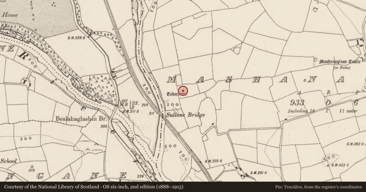
- Toberbaun (1901)
- Coordinates
- 51.88423, -8.92768
- SMR number
- CO071-128----
Slide toward Today to fade the historical sheet and see the modern map underneath.
David Rumsey Map Collection, Stanford LibrariesDavid Rumsey Map Collection, Stanford LibrariesDavid Rumsey Map Collection, Stanford LibrariesDavid Rumsey Map Collection, Stanford Libraries
4 historical maps cover this location, the earliest the 1790 map "Composite: Ireland." (David Rumsey Map Collection, Stanford Libraries).
Historical maps covering this location
- 1790 · Composite: Ireland. (David Rumsey Map Collection, Stanford Libraries)
- 1882 · Ireland (southern half). (David Rumsey Map Collection, Stanford Libraries)
- 1883 · Ireland 3. (David Rumsey Map Collection, Stanford Libraries)
- 1891 · Ireland 16 (David Rumsey Map Collection, Stanford Libraries)
This record in the National Monuments Service's Historic Environment Viewer ↗
The National Monuments Service's description
Known locally as 'Tobar an Ratha Bhain' (Hartnett 1947, 17). Identified as wheel-house of horizontal wheeled mill (9309) and excavated by Fahy (1956a,13-57), prior to flooding by Lee Valley Hydro-electric Scheme. He described well as having been 'three-walled, drystone structure (H 5ft; 2ft x 7ft) open to W but enclosed in a mound on the other three sides'; religious objects and personal mementoes were affixed to ash tree on W side; cups and containers in front. Believed to have cured infirm children; visited Easter Sunday, Palm Sunday and Whit Sunday. White pebbles found around well during excavation were identified by workmen as 'Hail Mary stones' (ibid.) deposited by pilgrims. Stone wheel-house survives.
The above description is derived from the published 'Archaeological Inventory of County Cork. Volume 3: Mid Cork' (Dublin: Stationery Office, 1997). In certain instances the entries have been revised and updated in the light of recent research.
Date of upload/revision: 14 January 2009
Nearby in the register
- Water mill - horizontal-wheeledunder 1 mi
- Moated siteunder 1 mi
- Kiln - corn-dryingunder 1 mi
- Fulacht fiaunder 1 mi
Other entries of the same register within about three miles of this one, by straight line.