Sites and Monuments Record · Ireland
Country house
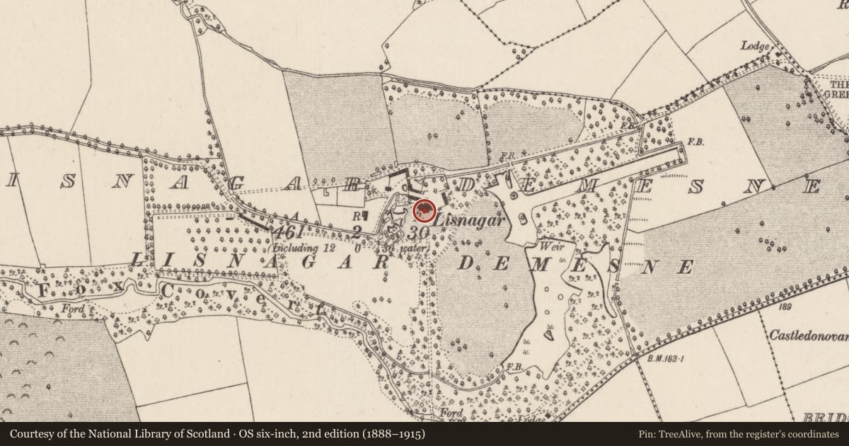
Lisnagar Demesne, County Cork, Ireland
The record
- Townland
- Lisnagar Demesne
- County
- Cork
- Country
- Ireland
- Latest-edition OS map
- Lisnagar (1935)
- Coordinates
- 52.07481, -8.29703
- SMR number
- CO044-011----
Slide toward Today to fade the historical sheet and see the modern map underneath.
David Rumsey Map Collection, Stanford LibrariesDavid Rumsey Map Collection, Stanford LibrariesDavid Rumsey Map Collection, Stanford LibrariesDavid Rumsey Map Collection, Stanford Libraries
4 historical maps cover this location, the earliest the 1790 map "Composite: Ireland." (David Rumsey Map Collection, Stanford Libraries).
Historical maps covering this location
- 1790 · Composite: Ireland. (David Rumsey Map Collection, Stanford Libraries)
- 1865 · Ireland, (South) Sheet. (David Rumsey Map Collection, Stanford Libraries)
- 1882 · Ireland (southern half). (David Rumsey Map Collection, Stanford Libraries)
- 1891 · Ireland 16 (David Rumsey Map Collection, Stanford Libraries)
This record in the National Monuments Service's Historic Environment Viewer ↗
The National Monuments Service's description
An early 18th century house; enlarged and remodelled in early 19th century by William Tonson in a Tudor-Gothic style (Bence-Jones 1978, 187), T-shaped in plan. Ornate 2-storey ivy-clad entrance front (S) with subsidiary gables and 2-storey porch, both adorned with pinnacles and finials; 3-sided bow projection with large mullioned windows. Slightly taller extension to E in a similar design with projecting bow. Embattled curtain wall extends E to gable of farmbuildings, with central ornate gabled archway. Large ornamental lake to E.
The above description is derived from the published 'Archaeological Inventory of County Cork. Volume 2: East and South Cork' (Dublin: Stationery Office, 1994). In certain instances the entries have been revised and updated in the light of recent research.
Date of upload/revision: 14 January 2009
Nearby in the register
- Enclosureunder 1 mi
- Fulacht fiaunder 1 mi
- Fulacht fiaunder 1 mi
- Excavation - miscellaneousunder 1 mi
Other entries of the same register within about three miles of this one, by straight line.