Sites and Monuments Record · Ireland
Holed stone (present location)
Kilquane (Barretts By.), County Cork, Ireland
The record
- Townland
- Kilquane (Barretts By.)
- County
- Cork
- Country
- Ireland
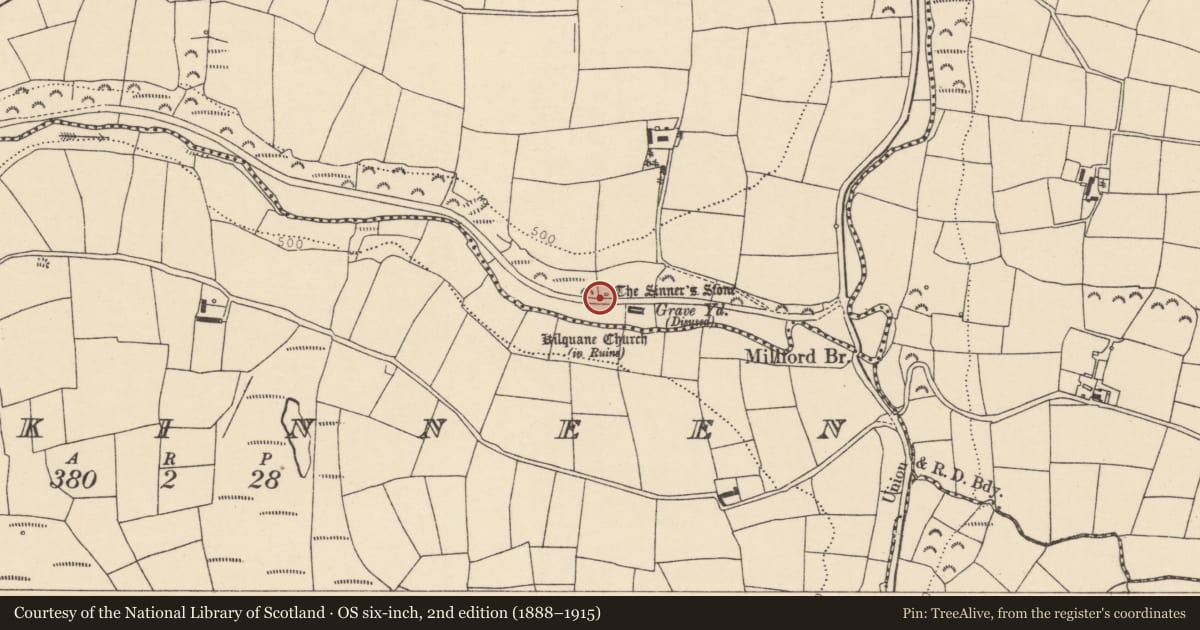
- Latest-edition OS map
- The Sinners Stone (1935)
- Coordinates
- 52.04742, -8.66189
- SMR number
- CO042-068002-
Slide toward Today to fade the historical sheet and see the modern map underneath.
David Rumsey Map Collection, Stanford LibrariesDavid Rumsey Map Collection, Stanford LibrariesDavid Rumsey Map Collection, Stanford LibrariesDavid Rumsey Map Collection, Stanford Libraries
4 historical maps cover this location, the earliest the 1790 map "Composite: Ireland." (David Rumsey Map Collection, Stanford Libraries).
Historical maps covering this location
- 1790 · Composite: Ireland. (David Rumsey Map Collection, Stanford Libraries)
- 1882 · Ireland (southern half). (David Rumsey Map Collection, Stanford Libraries)
- 1883 · Ireland 3. (David Rumsey Map Collection, Stanford Libraries)
- 1891 · Ireland 16 (David Rumsey Map Collection, Stanford Libraries)
This record in the National Monuments Service's Historic Environment Viewer ↗
The National Monuments Service's description
In pasture, at base of S-facing slope, on N side of road, directly opposite ruin of Kilquane church (CO042-068004-); prostrate slab (L 1.9m; 0.7m x 0.3m) with smooth hole (diam. 0.1m) drilled through it. Known locally as "Cloch na Peacaib" (the sinner's stone); according to Windele, writing in1848, 'women, nearing their confinement, used to draw clothes through the hole in order to ensure a favourable delivery' (Logan 1980, 106). According to Grove-White (1905-25, vol. 3, 323), the stone 'formerly stood a little higher up the ascent'. The road, which now separates the stone from the ruined church, was not constructed until the mid-19th century. Original location record CO042-113----.
The above description is derived from the published 'Archaeological Inventory of County Cork. Volume 3: Mid Cork' (Dublin: Stationery Office, 1997). In certain instances the entries have been revised and updated in the light of recent research.
Date of revision: 17 December 2009
Revised by: Mary Tunney
This monument is subject to a preservation order made under the National Monuments Acts 1930 to 2014 (PO no. 1/1993).
Nearby in the register
- Moundunder 1 mi
- Churchunder 1 mi
- Graveyardunder 1 mi
- Ringfort - rathunder 1 mi
Other entries of the same register within about three miles of this one, by straight line.