Sites and Monuments Record · Ireland
Fulacht fia
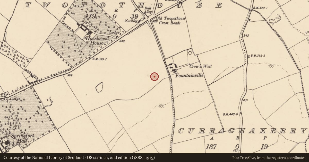
Two-Pot-House, County Cork, Ireland
The record
- Townland
- Two-Pot-House
- County
- Cork
- Country
- Ireland
- Coordinates
- 52.18870, -8.64448
- SMR number
- CO025-177----
Slide toward Today to fade the historical sheet and see the modern map underneath.
David Rumsey Map Collection, Stanford LibrariesDavid Rumsey Map Collection, Stanford LibrariesDavid Rumsey Map Collection, Stanford LibrariesDavid Rumsey Map Collection, Stanford Libraries
4 historical maps cover this location, the earliest the 1790 map "Composite: Ireland." (David Rumsey Map Collection, Stanford Libraries).
Historical maps covering this location
- 1790 · Composite: Ireland. (David Rumsey Map Collection, Stanford Libraries)
- 1882 · Ireland (southern half). (David Rumsey Map Collection, Stanford Libraries)
- 1883 · Ireland 3. (David Rumsey Map Collection, Stanford Libraries)
- 1904 · Sheet 13. (David Rumsey Map Collection, Stanford Libraries)
This record in the National Monuments Service's Historic Environment Viewer ↗
The National Monuments Service's description
Recorded by Mary Sleeman, Archaeologist with Cork County Council, on 19th October 2011. She describes it as 'spread of black charcoal-enriched soil with reddened heat-shattered stones- spread c. 15m N-S; c. 7m E-W.'
Nearby in the register
- Fulacht fiaunder 1 mi
- Fulacht fiaunder 1 mi
- Enclosureunder 1 mi
- Country houseunder 1 mi
Other entries of the same register within about three miles of this one, by straight line.