Sites and Monuments Record · Ireland
Country house
Park South (Fermoy By.), County Cork, Ireland
The record
- Townland
- Park South (Fermoy By.)
- County
- Cork
- Country
- Ireland
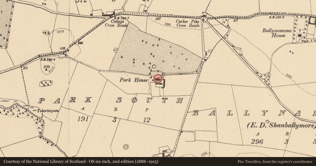
- Latest-edition OS map
- Park House (1936)
- Coordinates
- 52.22505, -8.52892
- SMR number
- CO018-056----
Slide toward Today to fade the historical sheet and see the modern map underneath.
David Rumsey Map Collection, Stanford LibrariesDavid Rumsey Map Collection, Stanford LibrariesDavid Rumsey Map Collection, Stanford LibrariesDavid Rumsey Map Collection, Stanford Libraries
4 historical maps cover this location, the earliest the 1790 map "Composite: Ireland." (David Rumsey Map Collection, Stanford Libraries).
Historical maps covering this location
- 1790 · Composite: Ireland. (David Rumsey Map Collection, Stanford Libraries)
- 1882 · Ireland (southern half). (David Rumsey Map Collection, Stanford Libraries)
- 1883 · Ireland 3. (David Rumsey Map Collection, Stanford Libraries)
- 1904 · Sheet 13. (David Rumsey Map Collection, Stanford Libraries)
This record in the National Monuments Service's Historic Environment Viewer ↗
The National Monuments Service's description
Two-storey house over basement, of mid-18th-century appearance; occupied. Entrance front (N) of coursed ashlar limestone: 5-bays wide, central 1-bay pedimented breakfront. Central rectangular door ope with rectangular fanlight and shouldered surround supporting a pediment; central 1st-floor Venetian window; Diocletian window in pediment. Narrow sash windows with shallow reveals: curved sills; limestone surrounds with prominent keystone. String course divides ground and 1st floor. Gable-ended with chimney stacks atop gables; moulded limestone cornice. Entrance front prolonged by lower 2-storey wings on E (4-bays) and W (1-bay) sides. Central 2-storey gabled projection to rear flanked by later lean-to additions. According to Grove White (1905-25, vol. 4, 152) 'in 1777, a house stood where Park House now stands' - but present house unlikely to be later than that date; according to owner, an earlier house may be incorporated into E wing.
The above description is derived from the published 'Archaeological Inventory of County Cork. Volume 4: North Cork' (Dublin: Stationery Office, 2000). In certain instances the entries have been revised and updated in the light of recent research.
Date of upload/revision: 14 January 2009
Nearby in the register
- Mill - cornunder 1 mi
- Ringfort - rathunder 1 mi
- Kiln - limeunder 1 mi
- Milling complexunder 1 mi
Other entries of the same register within about three miles of this one, by straight line.