Sites and Monuments Record · Ireland
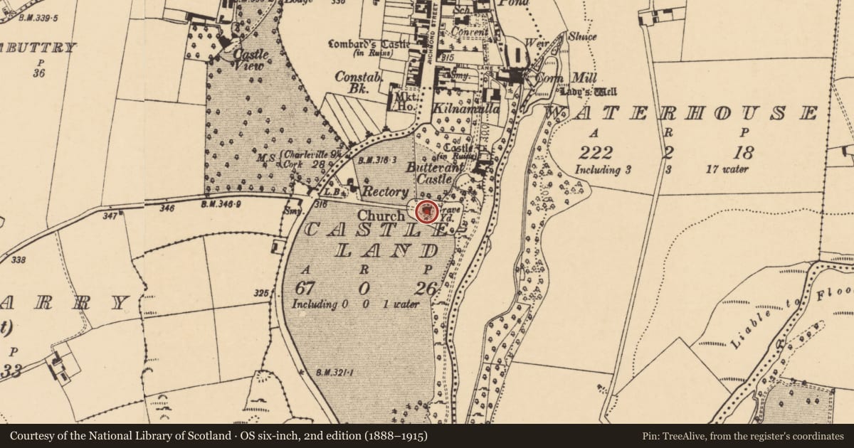
Church
Castleland, County Cork, Ireland
The record
- Townland
- Castleland
- County
- Cork
- Country
- Ireland
- Latest-edition OS map
- Church (1937)
- Coordinates
- 52.22689, -8.67037
- SMR number
- CO017-101002-
Slide toward Today to fade the historical sheet and see the modern map underneath.
David Rumsey Map Collection, Stanford LibrariesDavid Rumsey Map Collection, Stanford LibrariesDavid Rumsey Map Collection, Stanford LibrariesDavid Rumsey Map Collection, Stanford Libraries
4 historical maps cover this location, the earliest the 1790 map "Composite: Ireland." (David Rumsey Map Collection, Stanford Libraries).
Historical maps covering this location
- 1790 · Composite: Ireland. (David Rumsey Map Collection, Stanford Libraries)
- 1882 · Ireland (southern half). (David Rumsey Map Collection, Stanford Libraries)
- 1883 · Ireland 3. (David Rumsey Map Collection, Stanford Libraries)
- 1904 · Sheet 13. (David Rumsey Map Collection, Stanford Libraries)
This record in the National Monuments Service's Historic Environment Viewer ↗
The National Monuments Service's description
In graveyard (14558), on S side of Buttevant, immediately SW of Buttevant castle (14330). C of I parish church of Buttevant, in occasional use. Squat cruciform church, consisting of nave (long-axis E-W) with chancel to E, and transepts at E end of nave; tower to W. Built of coursed ashlar limestone. Corner buttresses throughout, topped by pinnacles; pinnacles also atop gables. Low one storey projections, set at 45 degree angle, between chancel and transepts. Pointed window opes throughout, with hood mouldings. Tall two storey buttressed tower at W end: embattled parapet with pinnacles; ribbed spire; rectangular door ope in W wall. Built in 1826 (Lewis 1837, vol. 1, 236), on site of earlier churches (see 14558), similar to C of I (14724). Designed by the Pain brothers (Mould 1991, 139). Early graveslab within church (see 14558).
The above description is derived from the published 'Archaeological Inventory of County Cork. Volume 4: North Cork' (Dublin: Stationery Office, 2000). In certain instances the entries have been revised and updated in the light of recent research.
Date of upload/revision: 14 January 2009
Nearby in the register
- Graveyardunder 1 mi
- Graveslabunder 1 mi
- Castle - Anglo-Norman masonry castleunder 1 mi
- Country houseunder 1 mi
Other entries of the same register within about three miles of this one, by straight line.