Sites and Monuments Record · Ireland
Country house
Castleland, County Cork, Ireland
The record
- Townland
- Castleland
- County
- Cork
- Country
- Ireland
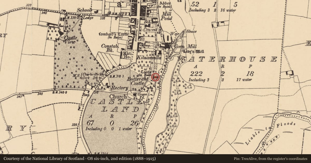
- Latest-edition OS map
- Buttevant Castle (1937)
- Coordinates
- 52.22781, -8.66866
- SMR number
- CO017-054002-
Slide toward Today to fade the historical sheet and see the modern map underneath.
David Rumsey Map Collection, Stanford LibrariesDavid Rumsey Map Collection, Stanford LibrariesDavid Rumsey Map Collection, Stanford LibrariesDavid Rumsey Map Collection, Stanford Libraries
4 historical maps cover this location, the earliest the 1790 map "Composite: Ireland." (David Rumsey Map Collection, Stanford Libraries).
Historical maps covering this location
- 1790 · Composite: Ireland. (David Rumsey Map Collection, Stanford Libraries)
- 1882 · Ireland (southern half). (David Rumsey Map Collection, Stanford Libraries)
- 1883 · Ireland 3. (David Rumsey Map Collection, Stanford Libraries)
- 1904 · Sheet 13. (David Rumsey Map Collection, Stanford Libraries)
This record in the National Monuments Service's Historic Environment Viewer ↗
The National Monuments Service's description
On top of a cliff edge, overlooking Awbeg River to E; C of I parish church (14708) on higher ground to S. Ruined castellated 3-storey house, built by John Anderson in early 19th century (Bence-Jones 1978, 51) incorporating part of earlier castle (14330). Entrance front (S) consists of three narrow central bays, with 4-storey circular tower of castle on SW corner, and matching but slightly smaller D-shaped 3-storey tower on SE corner. Central castellated porch; ogee-headed door ope (blocked); rectangular window opes on either side of porch with hood mouldings. Wide central 1st- and 2nd-floor windows. Tower of castle has numerous inserted rectangular window opes with hood mouldings; drain spout with carved face inserted on 2nd floor. Rear of house partially destroyed and heavily overgrown. Courtyard to rear with remains of 2-storey outbuildings.
The above description is derived from the published 'Archaeological Inventory of County Cork. Volume 4: North Cork' (Dublin: Stationery Office, 2000). In certain instances the entries have been revised and updated in the light of recent research.
Date of upload/revision: 14 January 2009
Nearby in the register
- Castle - Anglo-Norman masonry castleunder 1 mi
- Graveslabunder 1 mi
- Graveyardunder 1 mi
- Churchunder 1 mi
Other entries of the same register within about three miles of this one, by straight line.