Sites and Monuments Record · Ireland
Wall monument
Buttevant, County Cork, Ireland
The record
- Townland
- Buttevant
- County
- Cork
- Country
- Ireland
- First-edition OS map
- Not indicated
- Latest-edition OS map
- Not indicated
- Coordinates
- 52.23146, -8.66922
- SMR number
- CO017-053015-
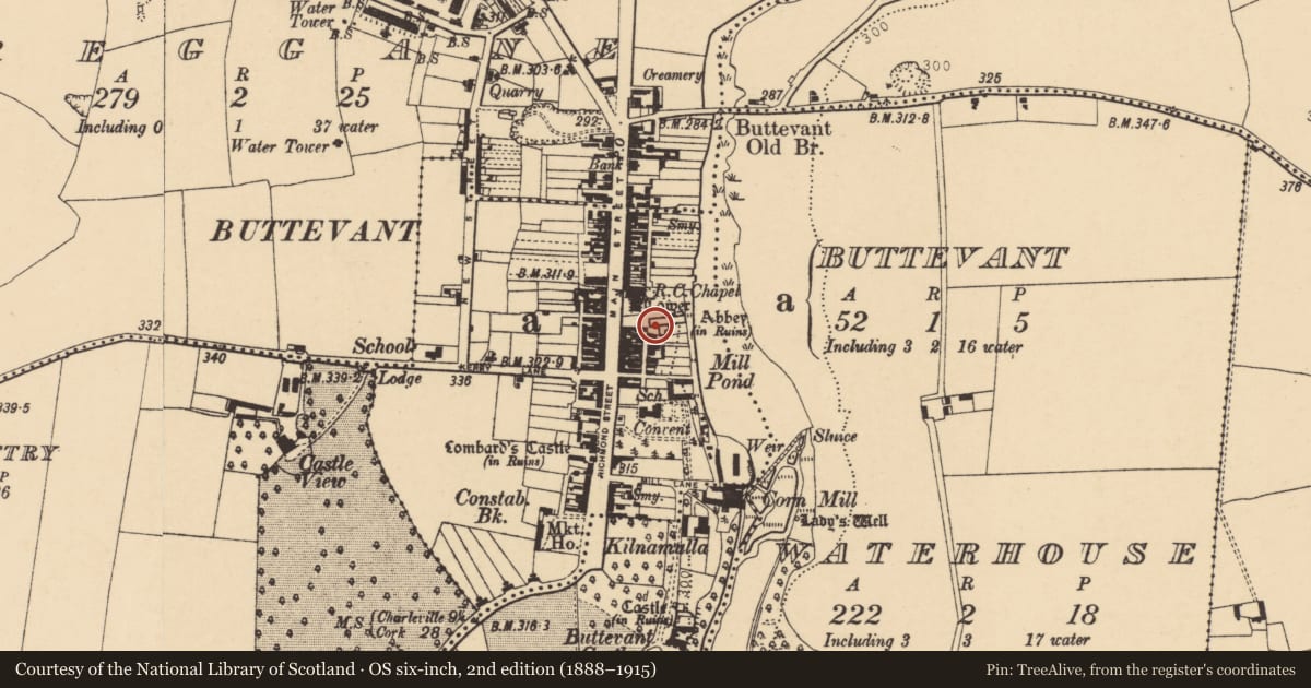
Slide toward Today to fade the historical sheet and see the modern map underneath.
David Rumsey Map Collection, Stanford LibrariesDavid Rumsey Map Collection, Stanford LibrariesDavid Rumsey Map Collection, Stanford LibrariesDavid Rumsey Map Collection, Stanford Libraries
4 historical maps cover this location, the earliest the 1790 map "Composite: Ireland." (David Rumsey Map Collection, Stanford Libraries).
Historical maps covering this location
- 1790 · Composite: Ireland. (David Rumsey Map Collection, Stanford Libraries)
- 1882 · Ireland (southern half). (David Rumsey Map Collection, Stanford Libraries)
- 1883 · Ireland 3. (David Rumsey Map Collection, Stanford Libraries)
- 1904 · Sheet 13. (David Rumsey Map Collection, Stanford Libraries)
This record in the National Monuments Service's Historic Environment Viewer ↗
The National Monuments Service's description
In the S wall of the nave of Buttevant Franciscan friary (CO017-053004-). This 13th-century wall tomb consists of a slab with a plain chamfer inserted in a recess, under a cinquefoiled arch with a rounded hood-moulding, resting on clustered columns with moulded capitals and moulded bases decorated with a line of nailhead ornament (Brash 1852a, 90). The hood moulding is decorated with a dogtooth ornament. This tomb is practically identical to another wall tomb in the N wall of the nave (CO017-053014-), although that tomb’s columns’ bases are not adorned with the nailhead motif, the capitals are decorated with a foliage carving, and the slab has a 17th-century inscription.
This tomb can be clearly dated to the middle of the 13th century and is likely to be coeval with construction of the church; the friary was established by David de Barry, lord of Buttevant, and became the Barrys’ main burial place. There was another near identical tomb in the S chapel of the church (CO017-053019-), though the arch was removed from its original position and inserted in the E wall of the small E chapel abutting the S chapel, where it forms part of an 18th-century chest tomb.
Compiled by Anne-Julie Lafaye
Date of upload: 25 November 2025
References
Brash, R.R. 1852a The local antiquities of Buttevant. Journal of the Royal Society of Antiquaries of Ireland 2, 83-96.
Nearby in the register
- Wall monumentunder 1 mi
- Religious house - Franciscan friarsunder 1 mi
- Graveyardunder 1 mi
- Churchunder 1 mi
Other entries of the same register within about three miles of this one, by straight line.