Sites and Monuments Record · Ireland
Ecclesiastical enclosure
Canon Island, County Clare, Ireland
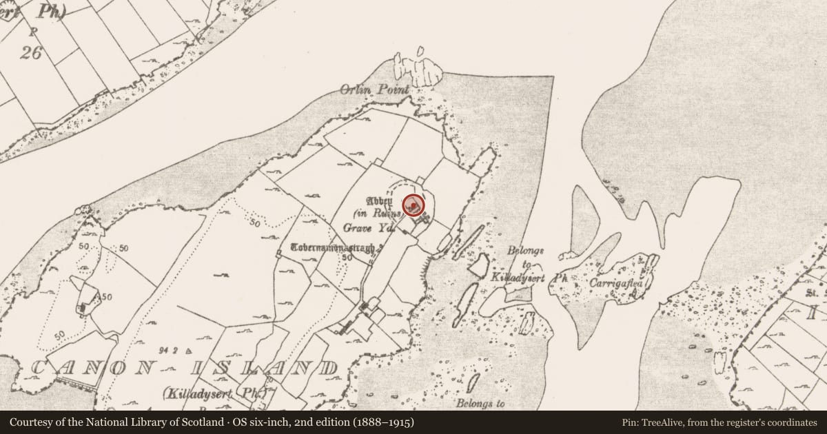
The record
- Townland
- Canon Island
- County
- Clare
- Country
- Ireland
- First-edition OS map
- Indicated
- Latest-edition OS map
- Indicated (1922)
- Coordinates
- 52.67938, -9.03744
- SMR number
- CL060-011001-
Slide toward Today to fade the historical sheet and see the modern map underneath.
David Rumsey Map Collection, Stanford LibrariesDavid Rumsey Map Collection, Stanford LibrariesDavid Rumsey Map Collection, Stanford LibrariesDavid Rumsey Map Collection, Stanford Libraries
4 historical maps cover this location, the earliest the 1790 map "Composite: Ireland." (David Rumsey Map Collection, Stanford Libraries).
Historical maps covering this location
- 1790 · Composite: Ireland. (David Rumsey Map Collection, Stanford Libraries)
- 1869 · Ireland. (David Rumsey Map Collection, Stanford Libraries)
- 1883 · Ireland 3. (David Rumsey Map Collection, Stanford Libraries)
- 1891 · Ireland 16 (David Rumsey Map Collection, Stanford Libraries)
This record in the National Monuments Service's Historic Environment Viewer ↗
The National Monuments Service's description
Westropp (1915, 272) in describing the ecclesiastical enclosure at Templemore (CL017-094001-) says ‘the wall is entirely overgrown and a thick hedge of bramble and hawthorn covers it, like the great, half demolished ring, in which the Abbey of Canons’ Island in the Fergus stands’. He includes a plan of Canon Island abbey (ibid., p. 271) showing the enclosure extant from N to SW. The area around the abbey (CL060-011001-) on Canon Island is very overgrown with near impenetrable vegetation cover. The enclosing feature is visible on an aerial photograph (CUCAP BGJ036) prior to the growth of vegetation. Part of a wall was identified E of the abbey in 2002, at its base was a bank (max. H 0.7m) but not enough remained to determine if it was curving. An arched gatehouse (CL060-011007-) lies along the line of the possible enclosure at SW.
Compiled by: Mary Tunney
Date of upload: 3 July 2019
References
Westropp, T.J. 1915 Prehistoric remains (forts and dolmens) in Burren and its south western border, Co. Clare. Part 12: North Western Part. Journal of the Royal Society of Antiquaries of Ireland 5, 45-62, 249-74.
Nearby in the register
- Religious house - Augustinian canonsunder 1 mi
- Graveslabunder 1 mi
- Graveslabunder 1 mi
- Graveslabunder 1 mi
Other entries of the same register within about three miles of this one, by straight line.