Sites and Monuments Record · Ireland
Cross - High cross
Kilfenora, County Clare, Ireland
The record
- Townland
- Kilfenora
- County
- Clare
- Country
- Ireland
- First-edition OS map
- Not indicated
- Latest-edition OS map
- Not indicated
- Coordinates
- 52.99076, -9.21685
- SMR number
- CL016-015008-
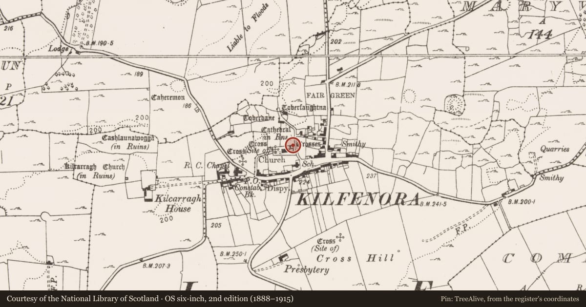
Slide toward Today to fade the historical sheet and see the modern map underneath.
David Rumsey Map Collection, Stanford LibrariesDavid Rumsey Map Collection, Stanford LibrariesDavid Rumsey Map Collection, Stanford LibrariesDavid Rumsey Map Collection, Stanford Libraries
4 historical maps cover this location, the earliest the 1753 map "Mappa geographica Regni Hiberniae" (David Rumsey Map Collection, Stanford Libraries).
Historical maps covering this location
- 1753 · Mappa geographica Regni Hiberniae (David Rumsey Map Collection, Stanford Libraries)
- 1790 · Composite: Ireland. (David Rumsey Map Collection, Stanford Libraries)
- 1869 · Ireland. (David Rumsey Map Collection, Stanford Libraries)
- 1891 · Ireland 16 (David Rumsey Map Collection, Stanford Libraries)
This record in the National Monuments Service's Historic Environment Viewer ↗
The National Monuments Service's description
Erected c. 2006 in the NW corner of the ‘sacristy’ situated N of the chancel in Kilfenora Cathedral (CL016-015002-) due to weathering. Listed in the SMR (1992) and the RMP (1996) as ‘Cross’. This is known as the ‘South cross’ which was found in 1954 in the ground S of the cathedral (de Paor 1955, 59). It was one of originally 6 limestone high crosses at Kilfenora, five of which are still there (see CL016-015005-, CL016-015006-, CL016-015007-, and CL016-015013-) and one of which was moved to Killaloe in 1821 (CL045-033009-). This cross is described by Harbison (1992, vol. 1, 115) as the fragmentary shaft of a cross (H 1.95m; shaft 0.72m x 0.18m at base (the shaft tapers towards the top)). The E face (now facing S) has a horizontal panel of Stafford knots, with a panel of closer-meshed interlace above it, at the present top of the shaft. The W face (now facing N) has part of a panel of interlace forming a circular device near the top. On each face the roll moulding at the edge curls into a spiral at the bottom. The sides are undecorated. This is a national monument in State care, no. 8.
The following image is uploaded:
CL016-015008-_01.jpg The E face of the South cross in its new location in the cathedral (now facing S).
Compiled by: Mary Tunney
Date of upload: 26 September 2017
References
Harbison, P. 1992 The high crosses of Ireland: an iconographical and photographic survey, 3 vols. Dublin. Royal Irish Academy. Bonn. Dr. Rudolf Habelt GMBH.
De Paor, L. 1955 The limestone crosses of Clare and Aran. Journal of the Galway Archaeological and Historical Society 26, 53-71.
Nearby in the register
- Cross - High crossunder 1 mi
- Cross - High crossunder 1 mi
- Cross - High crossunder 1 mi
- Cross - Churchyard crossunder 1 mi
Other entries of the same register within about three miles of this one, by straight line.