Sites and Monuments Record · Ireland
Barrow - unclassified
Glencolumbkille North, County Clare, Ireland
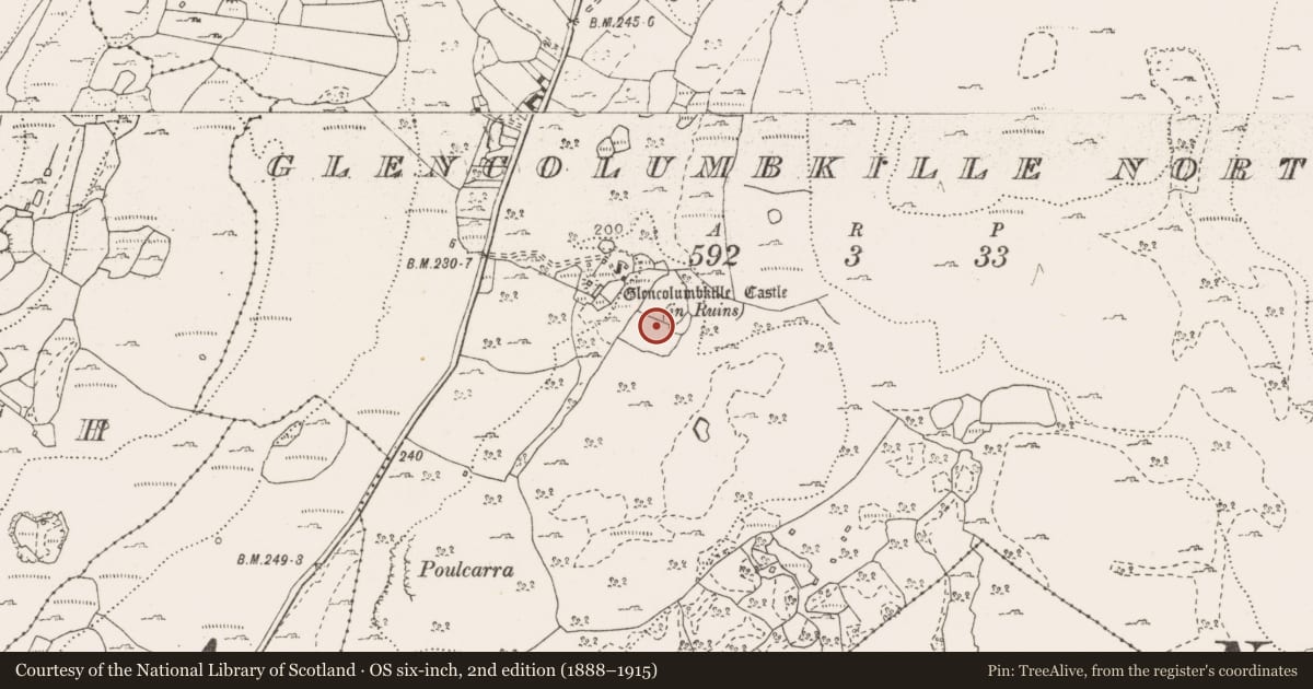
The record
- Townland
- Glencolumbkille North
- County
- Clare
- Country
- Ireland
- First-edition OS map
- Not indicated
- Latest-edition OS map
- Not indicated
- Coordinates
- 53.04839, -9.00768
- SMR number
- CL010-040003-
Slide toward Today to fade the historical sheet and see the modern map underneath.
David Rumsey Map Collection, Stanford LibrariesDavid Rumsey Map Collection, Stanford LibrariesDavid Rumsey Map Collection, Stanford LibrariesDavid Rumsey Map Collection, Stanford Libraries
4 historical maps cover this location, the earliest the 1753 map "Mappa geographica Regni Hiberniae" (David Rumsey Map Collection, Stanford Libraries).
Historical maps covering this location
- 1753 · Mappa geographica Regni Hiberniae (David Rumsey Map Collection, Stanford Libraries)
- 1790 · Composite: Ireland. (David Rumsey Map Collection, Stanford Libraries)
- 1869 · Ireland. (David Rumsey Map Collection, Stanford Libraries)
- 1891 · Ireland 16 (David Rumsey Map Collection, Stanford Libraries)
This record in the National Monuments Service's Historic Environment Viewer ↗
The National Monuments Service's description
On a slight pasture rise surrounded by overgrowth and scrub. Described by Coffey (1985, 27) as, ‘… a circular, fort-like mound surrounded by a ditch. It is defaced by a wall passing through the centre of the monument. Unlike an ordinary fort, this one has a centre built up high, and it looks very like a bell barrow or tumulus.’
A subcircular area (diams. c. 25m WNW-ESE; c. 23m NNE-SSW) is defined by a broad, flat-topped, grass-covered bank (Wth at base 4-5m; Wth at top 1m; H 0.6-1m) of stone and earth with most stone visible in the N half of the bank. The overgrown interior appears hollow, with a low scarp (H 0.7m) curving E-W in the S sector. A later field wall bisects the monument WNW-ESE. Several banks abut the external face of the enclosing bank exterior at E and ENE.
Glencolumbkille Castle tower house (CL010-040002-) lies c. 70m to the NW. There is an enclosure (CL010-040004-) c. 100m to the NNW.
Reference
Coffey, T. 1985 Field notes. The Other Clare 9, 27-31.
Compiled by: Gearóid Conroy and Conn Herriott
Date of upload: 20 February 2023
Nearby in the register
- House - medievalunder 1 mi
- Castle - tower houseunder 1 mi
- Bawnunder 1 mi
- Enclosureunder 1 mi
Other entries of the same register within about three miles of this one, by straight line.