Sites and Monuments Record · Ireland
Cist
Coolnatullagh (Burren By., Carran Par.), County Clare, Ireland
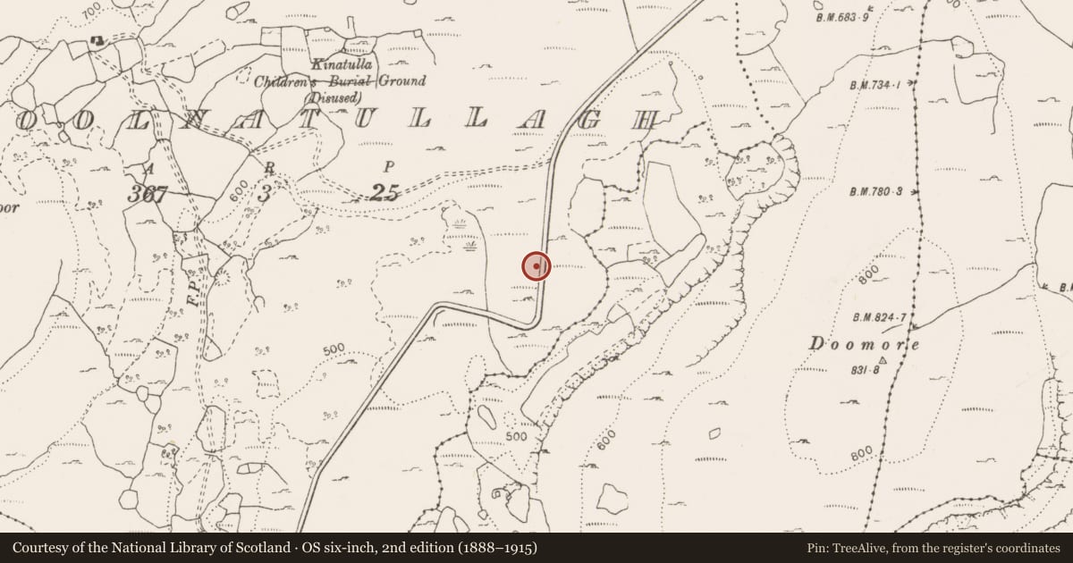
The record
- Townland
- Coolnatullagh (Burren By., Carran Par.)
- County
- Clare
- Country
- Ireland
- First-edition OS map
- Not indicated
- Latest-edition OS map
- Not indicated
- Coordinates
- 53.06907, -9.03159
- SMR number
- CL006-044002-
Slide toward Today to fade the historical sheet and see the modern map underneath.
David Rumsey Map Collection, Stanford LibrariesDavid Rumsey Map Collection, Stanford LibrariesDavid Rumsey Map Collection, Stanford LibrariesDavid Rumsey Map Collection, Stanford Libraries
4 historical maps cover this location, the earliest the 1753 map "Mappa geographica Regni Hiberniae" (David Rumsey Map Collection, Stanford Libraries).
Historical maps covering this location
- 1753 · Mappa geographica Regni Hiberniae (David Rumsey Map Collection, Stanford Libraries)
- 1790 · Composite: Ireland. (David Rumsey Map Collection, Stanford Libraries)
- 1869 · Ireland. (David Rumsey Map Collection, Stanford Libraries)
- 1891 · Ireland 16 (David Rumsey Map Collection, Stanford Libraries)
This record in the National Monuments Service's Historic Environment Viewer ↗
The National Monuments Service's description
At the approximate centre of a cairn (CL006-044----). Excavation carried out to facilitate repairs following the disturbance of the cairn revealed this central cist (Eogan 2002). The cist had been disturbed and comprised only two limestone slabs, a southern sidestone (H c. 0.8m; T c. 0.3m) and a capstone (L c. 0.95m; T c. 0.1m) (Eogan 2002, Fig 8). It contained two fills; a basal fill indistinguishable from the cairn and an upper black peaty silt. The partial remains of an adult inhumation, a child’s scapula and a cremation deposit containing at least one adult were recovered from the upper fill. A sample of the inhumed bone from the central cist returned a Chalcolithic date (2460–2140 cal BC). There were no finds within the cist, however, a perforated dog tooth, a glass bead, a possible stone pin sharpener, a chert scraper, a flint blade and several sherds of pottery were found elsewhere in the cairn (Eogan 2002, 127). A secondary inhumed burial was also found within the cairn.
Compiled by: Mary Tunney and Ros Ó Maoldúin
Date of upload: 27 July 2021
References
Eogan, J. 1998 Coolnatullagh, prehistoric cairn and field system. In I. Bennett (ed. ) Excavations 1997: summary accounts of archaeological excavations in Ireland, 5-6. Bray, Wordwell.
Eogan, J. 2002 Excavations at a cairn in Coolnatullagh townland, Co. Clare. North Munster Antiquarian Journal 42, 113-50.
Nearby in the register
- Cairn - burial cairnunder 1 mi
- Field systemunder 1 mi
- Enclosureunder 1 mi
- Cairn - unclassifiedunder 1 mi
Other entries of the same register within about three miles of this one, by straight line.