Sites and Monuments Record · Ireland
Ringfort - cashel
Ballynahown, County Clare, Ireland
The record
- Townland
- Ballynahown
- County
- Clare
- Country
- Ireland
- First-edition OS map
- Not indicated
- Latest-edition OS map
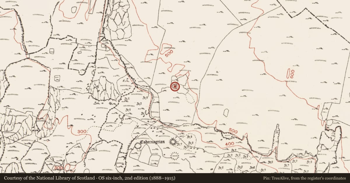
- Indicated (1915)
- Coordinates
- 53.06807, -9.33472
- SMR number
- CL004-061----
Slide toward Today to fade the historical sheet and see the modern map underneath.
David Rumsey Map Collection, Stanford LibrariesDavid Rumsey Map Collection, Stanford LibrariesDavid Rumsey Map Collection, Stanford LibrariesDavid Rumsey Map Collection, Stanford Libraries
4 historical maps cover this location, the earliest the 1753 map "Mappa geographica Regni Hiberniae" (David Rumsey Map Collection, Stanford Libraries).
Historical maps covering this location
- 1753 · Mappa geographica Regni Hiberniae (David Rumsey Map Collection, Stanford Libraries)
- 1790 · Composite: Ireland. (David Rumsey Map Collection, Stanford Libraries)
- 1869 · Ireland. (David Rumsey Map Collection, Stanford Libraries)
- 1891 · Ireland 16 (David Rumsey Map Collection, Stanford Libraries)
This record in the National Monuments Service's Historic Environment Viewer ↗
The National Monuments Service's description
Near the W base of a steep rocky crag, in an uneven and rocky area with good views from SSW to NW and within a large field system (CL004-027001-). Indicated on the 1915 OS 6-inch map. Listed as ‘Enclosure’ in the RMP (1996). Described by Westropp (1905, 349) as a ‘bold mass of crag’ which is ‘capped with a much-levelled fort’.
A poorly preserved, roughly D-shaped cashel (int. dims. 27m N-S; 23m E-W) defined by a stone wall (H 0.4-0.6m; max. H 1.3m at S and SW; Wth 2-3m) which is best preserved from S to WNW and with straight walls along the N (L c. 26m) and E (L c. 23m). Possible hut sites of uncertain date lie in the NW corner and inside the perimeter at SW and S. Possible animal pens occupy the NE corner and continue beyond the perimeter to E. A curving field wall (L c. 23m) runs through the interior of the site from W to E. The walls of an adjoining field abut the site at NW and NE.
Compiled by: Mary Tunney and Lynda McCormack
Date of upload: 10 October 2022
Nearby in the register
- Megalithic tomb - wedge tombunder 1 mi
- Hut siteunder 1 mi
- Ringfort - cashelunder 1 mi
- Fulacht fiaunder 1 mi
Other entries of the same register within about three miles of this one, by straight line.