Sites and Monuments Record · Ireland
Fulacht fia
Ballynahown, County Clare, Ireland
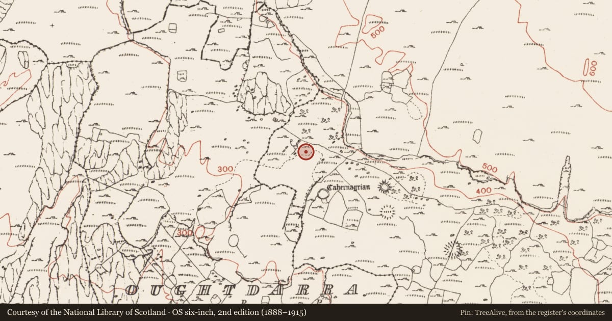
The record
- Townland
- Ballynahown
- County
- Clare
- Country
- Ireland
- First-edition OS map
- Not indicated
- Latest-edition OS map
- Not indicated
- Coordinates
- 53.06651, -9.33816
- SMR number
- CL004-082----
Slide toward Today to fade the historical sheet and see the modern map underneath.
David Rumsey Map Collection, Stanford LibrariesDavid Rumsey Map Collection, Stanford LibrariesDavid Rumsey Map Collection, Stanford LibrariesDavid Rumsey Map Collection, Stanford Libraries
4 historical maps cover this location, the earliest the 1753 map "Mappa geographica Regni Hiberniae" (David Rumsey Map Collection, Stanford Libraries).
Historical maps covering this location
- 1753 · Mappa geographica Regni Hiberniae (David Rumsey Map Collection, Stanford Libraries)
- 1790 · Composite: Ireland. (David Rumsey Map Collection, Stanford Libraries)
- 1869 · Ireland. (David Rumsey Map Collection, Stanford Libraries)
- 1891 · Ireland 16 (David Rumsey Map Collection, Stanford Libraries)
This record in the National Monuments Service's Historic Environment Viewer ↗
The National Monuments Service's description
On an upland karstic plateau, in a grassy bay bordered on its N side by a rising bedrock scarp from the base of which a number of springs issue, and within an extensive field system (CL004-027001-). A low, sod-covered flat-topped mound (10m N−S; 9m E−W; H 0.6m at SE) incorporating a shallow, poorly defined depression at NW, which is marked by richer grass growth and most likely indicates the location of the trough. The E−SE arc of the mound is well defined, the NW edge is lower and less distinct and the N edge abuts a rising rocky scarp. A concentration of limestone fragments in a matrix of black charcoal-rich soil is exposed on the eroded SE−S edge of the mound. A spring skirts the mound at E−S, flowing over the smooth surface of exposed limestone pavement, and continues to W where it merges with other springs in an area of damp, soggy ground. A number of close-set boulder line the edge of the stream immediately to W of the fulacht fia.
The following images have been uploaded:
CL004-082----_01.jpg View from E
CL004-082----_02.jpg View from S
CL004-082----_03.jpg View from NW
CL004-082----_04.jpg Burnt stone and charcoal exposed at S edge of mound
CL004-082----_05.jpg Row of large stones bordering the spring immediately W of the fulacht fia
Compiled by: Mary Tunney and Jane O'Shaughnessy
Date of upload: 10 November 2021
Nearby in the register
- Ringfort - cashelunder 1 mi
- Enclosureunder 1 mi
- Hut siteunder 1 mi
- Ringfort - cashelunder 1 mi
Other entries of the same register within about three miles of this one, by straight line.