Sites and Monuments Record · Ireland
Enclosure
Crumlin, County Clare, Ireland
The record
- Townland
- Crumlin
- County
- Clare
- Country
- Ireland
- First-edition OS map
- Not indicated
- Latest-edition OS map
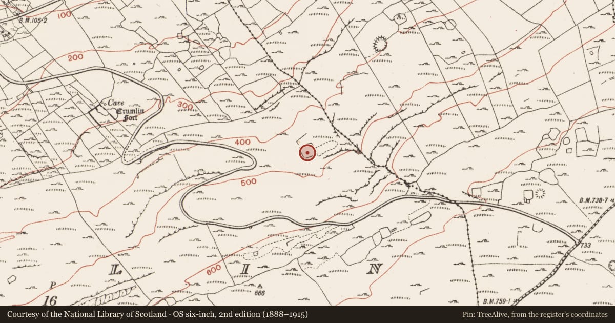
- Indicated (1915)
- Coordinates
- 53.08166, -9.31096
- SMR number
- CL004-034----
Slide toward Today to fade the historical sheet and see the modern map underneath.
David Rumsey Map Collection, Stanford LibrariesDavid Rumsey Map Collection, Stanford LibrariesDavid Rumsey Map Collection, Stanford LibrariesDavid Rumsey Map Collection, Stanford Libraries
4 historical maps cover this location, the earliest the 1753 map "Mappa geographica Regni Hiberniae" (David Rumsey Map Collection, Stanford Libraries).
Historical maps covering this location
- 1753 · Mappa geographica Regni Hiberniae (David Rumsey Map Collection, Stanford Libraries)
- 1790 · Composite: Ireland. (David Rumsey Map Collection, Stanford Libraries)
- 1869 · Ireland. (David Rumsey Map Collection, Stanford Libraries)
- 1891 · Ireland 16 (David Rumsey Map Collection, Stanford Libraries)
This record in the National Monuments Service's Historic Environment Viewer ↗
The National Monuments Service's description
On a high (between 400’ and 500’ contours) level terrace with good views over lower ground from WNW-NE and overlooked by steeper rocky ground from E to W. Within a large field system (CL004-098----). Not recorded on the first edition (1842) of the OS 6-inch map but indicated on the later Cassini edition (1915 OS) . Listed as ‘enclosure’ in the RMP (1996).
A roughly square area (int. dims. 38m WSW-ENE; 38m NNW-SSE) is defined by a drystone wall which varies in thickness (T 1.1m in WSW; 1.3m in SSE; 1.5m in ESE) and height (max. ext. H 2.2m in NW; 0.6-1m in N and E) and has rounded corners at NW and NE. Low, inner wall facing (H 0.1-0.2m) is visible intermittently where it has been exposed by livestock poaching and the S-limits, especially at the SE and SW corners are heavily overgrown with blackthorn and briar. A poorly preserved, rectangular structure (c. 16m ENE-WSW; c. 6m NNW-SSE) abuts the enclosing wall in the NE sector of the interior, and a broad, low bank (Wth 2-2.5m; H 0.7-0.9m) runs NE-SW in the W interior.
Compiled by: Gearóid Conroy and Lynda McCormack
Date of upload: 25 October 2022
Nearby in the register
- Ringfort - cashelunder 1 mi
- Ringfort - cashelunder 1 mi
- Hut siteunder 1 mi
- Ringfort - cashelunder 1 mi
Other entries of the same register within about three miles of this one, by straight line.