Sites and Monuments Record · Ireland
Ringfort - cashel
Craggagh, County Clare, Ireland
The record
- Townland
- Craggagh
- County
- Clare
- Country
- Ireland
- First-edition OS map
- Hachured
- Latest-edition OS map
- Hachured (1915)
- Coordinates
- 53.09696, -9.30587
- SMR number
- CL004-006----
Slide toward Today to fade the historical sheet and see the modern map underneath.
David Rumsey Map Collection, Stanford LibrariesDavid Rumsey Map Collection, Stanford LibrariesDavid Rumsey Map Collection, Stanford LibrariesDavid Rumsey Map Collection, Stanford Libraries
4 historical maps cover this location, the earliest the 1753 map "Mappa geographica Regni Hiberniae" (David Rumsey Map Collection, Stanford Libraries).
Historical maps covering this location
- 1753 · Mappa geographica Regni Hiberniae (David Rumsey Map Collection, Stanford Libraries)
- 1790 · Composite: Ireland. (David Rumsey Map Collection, Stanford Libraries)
- 1869 · Ireland. (David Rumsey Map Collection, Stanford Libraries)
- 1891 · Ireland 16 (David Rumsey Map Collection, Stanford Libraries)
This record in the National Monuments Service's Historic Environment Viewer ↗
The National Monuments Service's description
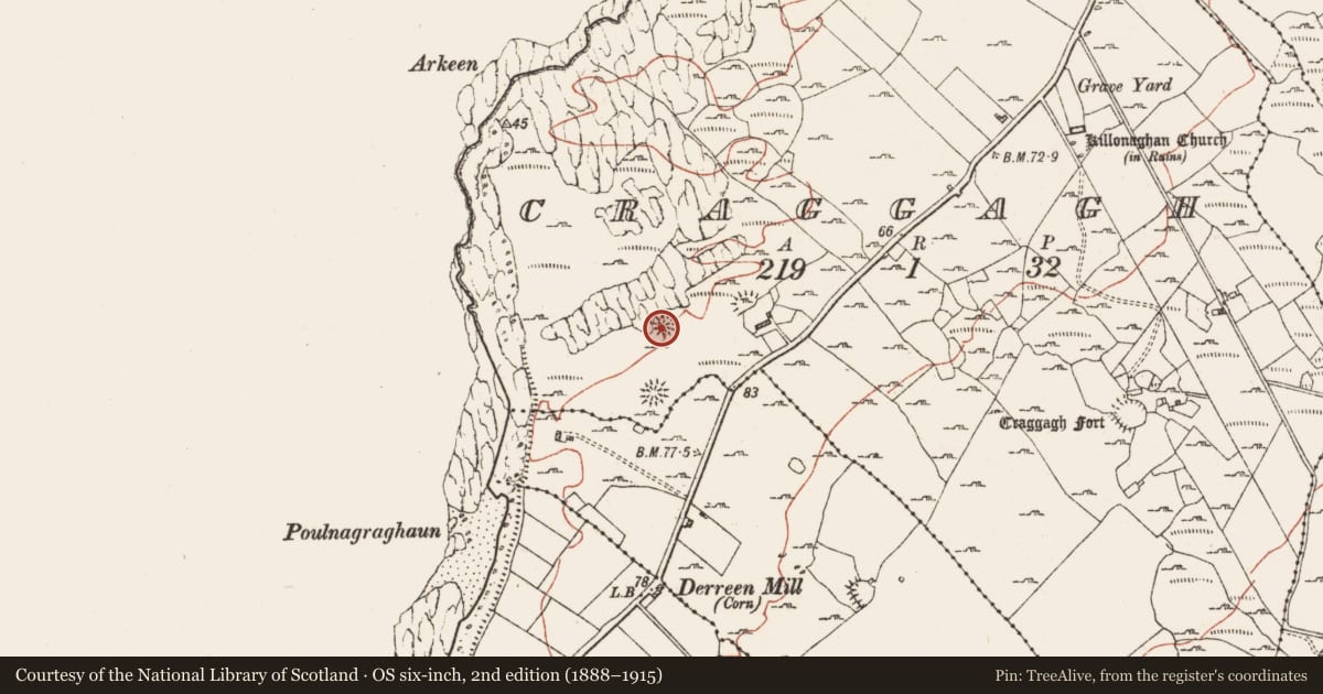
On slightly raised ground in an otherwise low-lying location with good views over W–N and within a field system (CL004-102----). Hachured on the 1842 and 1915 eds. of the OS 6-inch maps. Listed as ‘Enclosure’ in the SMR (1992) and the RMP (1996). A largely overgrown roughly circular cashel (21.6m N–S; 21.8m E–W) defined by a spread of stone (Wth 3.8–4.5m; av. int. H 0.5m) with outer facing-stones surviving particularly well from W–NE (max. H 2.1m). The interior slopes down to the S and a roughly circular outline of stones (4m N–S by 5m E–W; H 0.6m) is visible in the WNW sector (CL004-006001-). The interior is particularly heavily overgrown towards N and along SW. There is another cashel c. 60m to the S (CL004-005----) and two enclosures, one c. 60m to the ENE (CL004-008----) and the other c. 240m to the ESE (CL004-010----). Several of the field walls surrounding this cashel and its neighbour (CL004-005----) may be ancient.
Compiled by: Mary Tunney and Ros Ó Maolduin
Date of upload: 17 February 2021
Nearby in the register
- Hut siteunder 1 mi
- Ringfort - cashelunder 1 mi
- Ringfort - rathunder 1 mi
- Enclosureunder 1 mi
Other entries of the same register within about three miles of this one, by straight line.