Cof Cymru: National Historic Assets of Wales · Wales
Llyn Gwyn Earthwork
Nantmel, Powys, Wales
A scheduled monument in Nantmel, Powys, recorded as Earthwork (unclassified).
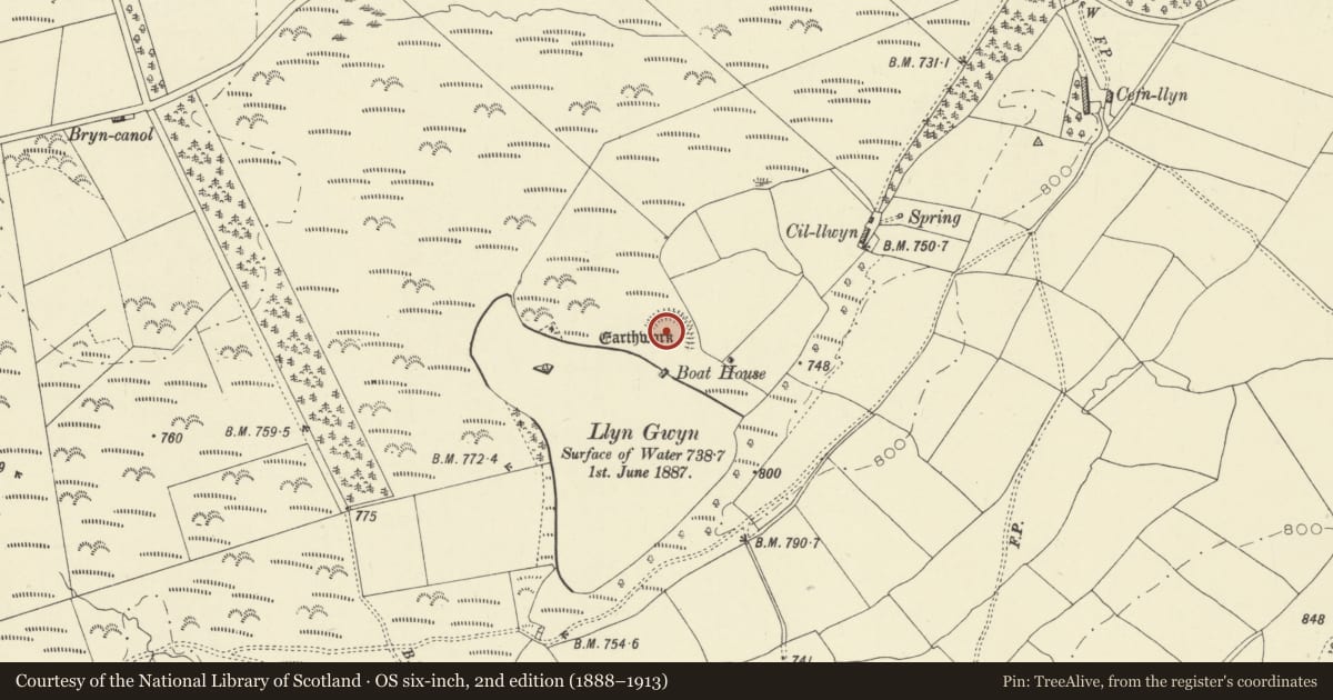
The record
- Designation
- Scheduled monument
- Site type
- Earthwork (unclassified)
- Period
- Unknown
- Community
- Nantmel
- Unitary authority
- Powys
- Country
- Wales
- Coordinates (centre of the scheduled area)
- 52.27467, -3.44871
- SAM number
- RD079
- Cadw record number
- 1937
Slide toward Today to fade the historical sheet and see the modern map underneath.
David Rumsey Map Collection, Stanford LibrariesDavid Rumsey Map Collection, Stanford LibrariesDavid Rumsey Map Collection, Stanford LibrariesDavid Rumsey Map Collection, Stanford LibrariesDavid Rumsey Map Collection, Stanford Libraries
5 historical maps cover this location, the earliest the 1608 map "(13) Cambriae Typus." (David Rumsey Map Collection, Stanford Libraries).
Historical maps covering this location
- 1608 · (13) Cambriae Typus. (David Rumsey Map Collection, Stanford Libraries)
- 1637 · Particular description of Wales. Cambria seu Wallia (David Rumsey Map Collection, Stanford Libraries)
- 1883 · Watershed map England, Wales 3. (David Rumsey Map Collection, Stanford Libraries)
- 1898 · 179 Rhyader (Hills) (David Rumsey Map Collection, Stanford Libraries)
- 1901 · Sheet 14. (David Rumsey Map Collection, Stanford Libraries)
Cadw's description
Summary description and reason for designation
The following provides a general description of the Scheduled Monument.
The Llyn Gwyn Earthwork consists of a crescent-shaped bank with an outer V-shaped ditch, enclosing an area of c.50m by c.24m. The scarp along the otherwise open south-west side probably represents the original bank of the lake, which is somewhat smaller today, and the ditch may have been water-filled. The remains are not especially diagnostic as to date, though they are traditionally associated with Strata Florida Abbey.
The monument is of national importance for its potential to enhance our knowledge of defensive, agricultural or settlement organisation. It retains significant archaeological potential, with a strong probability of the presence of associated archaeological features and deposits.
The scheduled area comprises the remains described and areas around them within which related evidence may be expected to survive.
Nearby in the register
- Llwynbarried HallDomesticunder 1 mi
- Barn at Dolau FarmNo class recorded1 mi
- Dolau Siphon Outlet HouseNo class recorded1 mi
- Dolau Siphon Inlet HouseNo class recorded1 mi
Other entries of the same register within about three miles of this one, by straight line.