Cof Cymru: National Historic Assets of Wales · Wales
Standing Stone 350m N of Knightston Farm
St. Mary Out Liberty, Pembrokeshire, Wales
A scheduled monument in St. Mary Out Liberty, Pembrokeshire, recorded as Standing Stone (Prehistoric).
The record
- Designation
- Scheduled monument
- Site type
- Standing Stone
- Period
- Prehistoric
- Date of designation
- 4 August 2006
- Community
- St. Mary Out Liberty
- Unitary authority
- Pembrokeshire
- Country
- Wales
- Coordinates (centre of the scheduled area)
- 51.69590, -4.71668
- SAM number
- PE511
- Cadw record number
- 1156
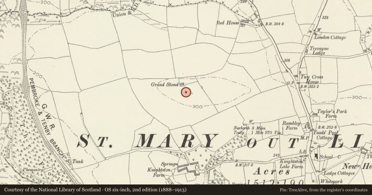
Slide toward Today to fade the historical sheet and see the modern map underneath.
David Rumsey Map Collection, Stanford LibrariesDavid Rumsey Map Collection, Stanford LibrariesDavid Rumsey Map Collection, Stanford LibrariesDavid Rumsey Map Collection, Stanford LibrariesDavid Rumsey Map Collection, Stanford Libraries
5 historical maps cover this location, the earliest the 1636 map "Cornubia : Devonia, Somersetus, Dorcestria, Wiltonia, Glocestria ..." (David Rumsey Map Collection, Stanford Libraries).
Historical maps covering this location
- 1636 · Cornubia : Devonia, Somersetus, Dorcestria, Wiltonia, Glocestria ... (David Rumsey Map Collection, Stanford Libraries)
- 1637 · The fourth table of England. Cornub. Devonia, Somerset etc. (David Rumsey Map Collection, Stanford Libraries)
- 1891 · Sheet 10. Ordnance Survey of England and Wales. . (David Rumsey Map Collection, Stanford Libraries)
- 1898 · 228 Haverfordwest (Hills) (David Rumsey Map Collection, Stanford Libraries)
- 1901 · Sheet 13. (David Rumsey Map Collection, Stanford Libraries)
Cadw's description
Summary description and reason for designation
The following provides a general description of the Scheduled Ancient Monument.
A magnificent sandstone monolith, measuring 2.1m tall, 0.65m wide and 0.4m deep, located on a flattened ridge top. It is earthfast, oriented E-W and tapers to a blunt and square point.
The standing stone is thought to be of religious or ceremonial significance and to date to the Bronze Age (c.2300 BC - 800 BC). This example is an important local landmark. The monument is likely to retain significant archaeological deposits and enhance our knowledge of prehistoric ritual practices.
The area to be scheduled comprises the remains described and an area around them within which related evidence may be expected to survive. It is circular and measures 6m in diameter.
Nearby in the register
- Knightston FarmhouseDomesticunder 1 mi
- Cartshed attached to Knightston FarmAgriculture and Subsistenceunder 1 mi
- Former Malthouse and Bakery attached to Knightston FarmhouseIndustrialunder 1 mi
- Rhode Wood Shaft MoundsShaft Mounds1 mi
Other entries of the same register within about three miles of this one, by straight line.