Cof Cymru: National Historic Assets of Wales · Wales
Burnt Mound 160m E of Woodsend
Walwyn's Castle, Pembrokeshire, Wales
A scheduled monument in Walwyn's Castle, Pembrokeshire, recorded as Burnt Mound (Prehistoric).
The record
- Designation
- Scheduled monument
- Site type
- Burnt Mound
- Period
- Prehistoric
- Date of designation
- 21 November 1995
- Community
- Walwyn's Castle
- Unitary authority
- Pembrokeshire
- Country
- Wales
- Coordinates (centre of the scheduled area)
- 51.75141, -5.07432
- SAM number
- PE475
- Cadw record number
- 1444
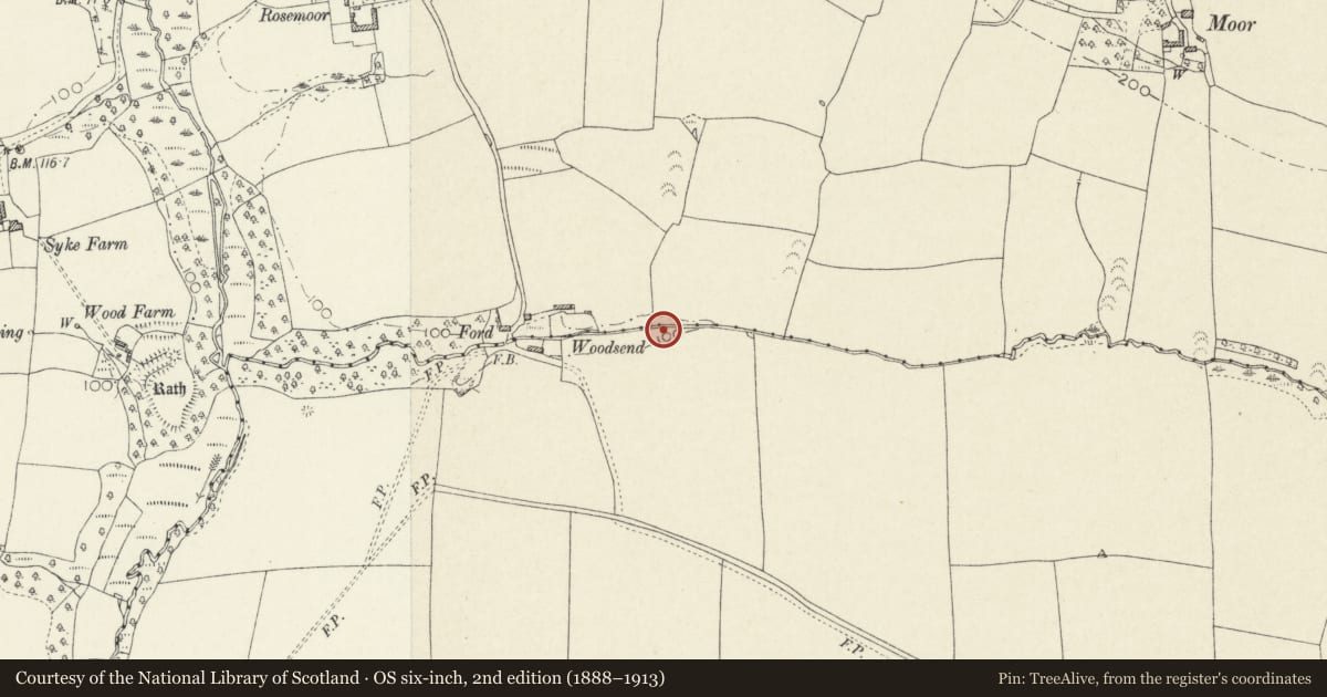
Slide toward Today to fade the historical sheet and see the modern map underneath.
David Rumsey Map Collection, Stanford LibrariesDavid Rumsey Map Collection, Stanford LibrariesDavid Rumsey Map Collection, Stanford LibrariesDavid Rumsey Map Collection, Stanford LibrariesDavid Rumsey Map Collection, Stanford Libraries
5 historical maps cover this location, the earliest the 1608 map "(13) Cambriae Typus." (David Rumsey Map Collection, Stanford Libraries).
Historical maps covering this location
- 1608 · (13) Cambriae Typus. (David Rumsey Map Collection, Stanford Libraries)
- 1636 · Cornubia : Devonia, Somersetus, Dorcestria, Wiltonia, Glocestria ... (David Rumsey Map Collection, Stanford Libraries)
- 1898 · 227 Milford (Hills) (David Rumsey Map Collection, Stanford Libraries)
- 1898 · 227 Milford (Outline) (David Rumsey Map Collection, Stanford Libraries)
- 1901 · Sheet 13. (David Rumsey Map Collection, Stanford Libraries)
Cadw's description
Summary description and reason for designation
The following provides a general description of the Scheduled Ancient Monument.
The monument consists of the remains of a burnt mound, probably dating to the Bronze Age (c. 2,300BC - 800BC). A burnt mound is an accumulation of burnt (fire-crazed) stones, ash and charcoal, usually sited next to a river or lake, with hearths and/or some form of trough or basin capable of holding water either within the mound or adjacent to it. This low shield-shaped mound lies at the foot of a north-facing hill, a few metres to the south of and aligned with a small stream. It measures 7.5m in length, 5.5m in width and is 0.4m high. The surface of the mound contains numerous small stones and an auger survey of the interior revealed black soil and burnt stone.
The monument is of national importance for its potential to enhance our knowledge of prehistoric ritual and funerary practices. It retains significant archaeological potential, with a strong probability of the presence of associated archaeological features and deposits. The structure itself may be expected to contain archaeological information concerning chronology and environmental evidence. A burnt mound may be part of a larger cluster of monuments and their importance can further enhanced by their group value.
The scheduled area comprises the remains described and areas around them within which related evidence may be expected to survive.
Nearby in the register
- Syke RathPromontory Fort - inlandunder 1 mi
- Church of Saint AndrewReligious, Ritual and Funeraryunder 1 mi
- Rath S of St James ChurchRathunder 1 mi
- Church of St James the GreatReligious, Ritual and Funeraryunder 1 mi
Other entries of the same register within about three miles of this one, by straight line.