Cof Cymru: National Historic Assets of Wales · Wales
Cottage, Mill and Lime Kiln at Caerbwdy
St. David's and the Cathedral Close, Pembrokeshire, Wales
A scheduled monument in St. David's and the Cathedral Close, Pembrokeshire, recorded as Mill (Post Medieval/Modern).
The record
- Designation
- Scheduled monument
- Site type
- Mill
- Period
- Post Medieval/Modern
- Community
- St. David's and the Cathedral Close
- Unitary authority
- Pembrokeshire
- Country
- Wales
- Coordinates (centre of the scheduled area)
- 51.87457, -5.24521
- SAM number
- PE429
- Cadw record number
- 447
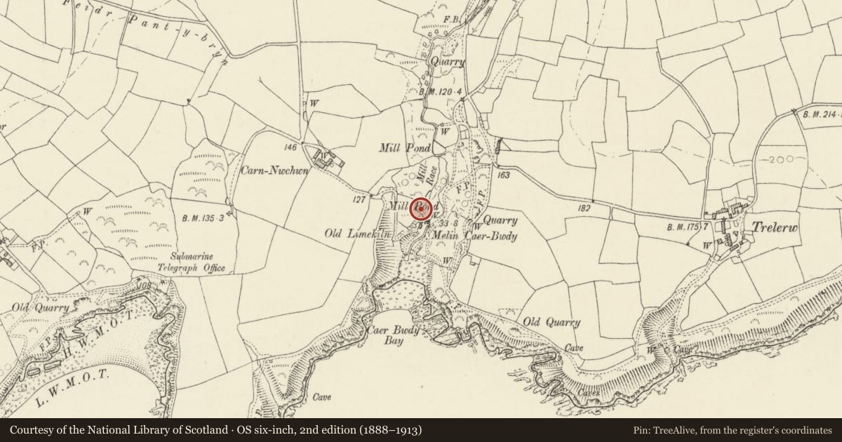
Slide toward Today to fade the historical sheet and see the modern map underneath.
David Rumsey Map Collection, Stanford LibrariesDavid Rumsey Map Collection, Stanford LibrariesDavid Rumsey Map Collection, Stanford LibrariesDavid Rumsey Map Collection, Stanford LibrariesDavid Rumsey Map Collection, Stanford Libraries
5 historical maps cover this location, the earliest the 1608 map "(13) Cambriae Typus." (David Rumsey Map Collection, Stanford Libraries).
Historical maps covering this location
- 1608 · (13) Cambriae Typus. (David Rumsey Map Collection, Stanford Libraries)
- 1636 · Cornubia : Devonia, Somersetus, Dorcestria, Wiltonia, Glocestria ... (David Rumsey Map Collection, Stanford Libraries)
- 1637 · Particular description of Wales. Cambria seu Wallia (David Rumsey Map Collection, Stanford Libraries)
- 1898 · 209 St David's (Hills) (David Rumsey Map Collection, Stanford Libraries)
- 1901 · Sheet 13. (David Rumsey Map Collection, Stanford Libraries)
Cadw's description
Summary description and reason for designation
The following provides a general description of the Scheduled Ancient Monument.
The monument consists of the remains of a mill, a factory used for processing raw materials. The complex includes a mill, cottage and limekilns to the west. The mill building stands to eaves level and the wheel pit is structurally sound with part of the water wheel having collapsed into the bottom of the pit. The mill pond and mill race, though overgrown, can be traced on the north of the mill. The contiguous cottage to the south of the mill is less well preserved though the masonry still stands to 2m in height. A fine lime kiln, very well preserved, stands to the west. Probably 19th century in date.
The monument is of national importance for its potential to enhance our knowledge of manufacturing techniques and processes. It retains significant archaeological potential, with a strong probability of the presence of associated archaeological features and deposits. The structure itself may be expected to contain archaeological information concerning chronology and building techniques.
The scheduled area comprises the remains described and areas around them within which related evidence may be expected to survive.
Nearby in the register
- Limekiln to SW.of ruins of Caerbwdy MillIndustrialunder 1 mi
- Caerfai CampPromontory Fort - coastalunder 1 mi
- Clegyr UchafDomesticunder 1 mi
- Twr Y Felin (former Windmill Tower only)Industrialunder 1 mi
Other entries of the same register within about three miles of this one, by straight line.