Cof Cymru: National Historic Assets of Wales · Wales
West Tarr Vaulted Hall House
Penally, Pembrokeshire, Wales
A scheduled monument in Penally, Pembrokeshire, recorded as House (domestic) (Medieval).
The record
- Designation
- Scheduled monument
- Site type
- House (domestic)
- Period
- Medieval
- Date of designation
- 13 June 1985
- Community
- Penally
- Unitary authority
- Pembrokeshire
- Country
- Wales
- Coordinates (centre of the scheduled area)
- 51.67341, -4.76501
- SAM number
- PE423
- Cadw record number
- 2732
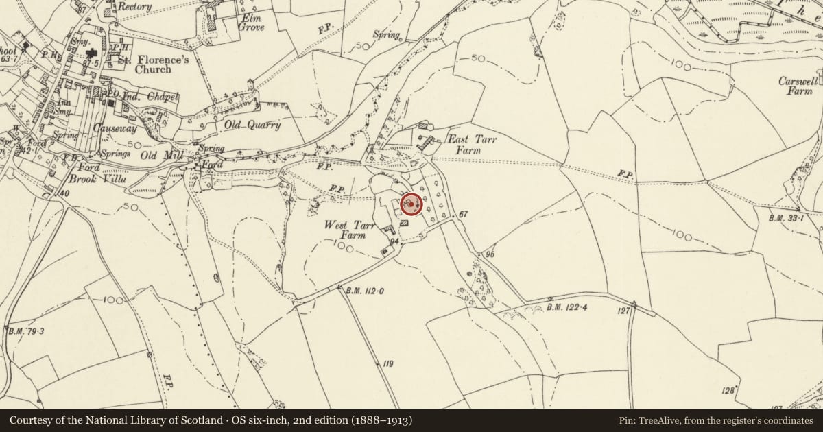
Slide toward Today to fade the historical sheet and see the modern map underneath.
David Rumsey Map Collection, Stanford LibrariesDavid Rumsey Map Collection, Stanford LibrariesDavid Rumsey Map Collection, Stanford LibrariesDavid Rumsey Map Collection, Stanford LibrariesDavid Rumsey Map Collection, Stanford Libraries
5 historical maps cover this location, the earliest the 1636 map "Cornubia : Devonia, Somersetus, Dorcestria, Wiltonia, Glocestria ..." (David Rumsey Map Collection, Stanford Libraries).
Historical maps covering this location
- 1636 · Cornubia : Devonia, Somersetus, Dorcestria, Wiltonia, Glocestria ... (David Rumsey Map Collection, Stanford Libraries)
- 1865 · England and Wales. England No. 6. (David Rumsey Map Collection, Stanford Libraries)
- 1891 · Sheet 10. Ordnance Survey of England and Wales. . (David Rumsey Map Collection, Stanford Libraries)
- 1898 · 245 Pembroke (Hills) (David Rumsey Map Collection, Stanford Libraries)
- 1901 · Sheet 13. (David Rumsey Map Collection, Stanford Libraries)
Cadw's description
Summary description and reason for designation
The following provides a general description of the Scheduled Ancient Monument.
The monument consists of the remains of a house measuring 7.5m long, 5m wide, 6.5m high to ridge. It is stone built and consists of two stone vaults, a 2.3m high ground floor flat vault, with a 3.8m high more pointed vault on 1st floor level. The remains of the lateral chimney are scanty, as the upper part has gone, and the lower part has been broken through to provide the first floor entrance. One ground floor end wall has gone, but the position of the stair linking the two floors is clear. Both floors have medieval slit windows. The roof is slate, but in poor condition. Referred to in documents along with Carswell, with which it is closely related.
The monument is of national importance for its potential to enhance our knowledge of settlement and domestic activity. It retains significant archaeological potential, with a strong probability of the presence of associated archaeological features and deposits. The structure itself may be expected to contain archaeological information concerning chronology and building techniques. A house may be part of a larger cluster of monuments and their importance can further enhanced by their group value.
The scheduled area comprises the remains described and areas around them within which related evidence may be expected to survive.
Nearby in the register
- West Tarr Mediaeval HouseDomesticunder 1 mi
- Old Building East of West Tarr Medieval HouseAgriculture and Subsistenceunder 1 mi
- Bethel Congregational ChapelReligious, Ritual and Funeraryunder 1 mi
- Old ChimneysDomesticunder 1 mi
Other entries of the same register within about three miles of this one, by straight line.