Cof Cymru: National Historic Assets of Wales · Wales
Monkton Priory Dovecot
Pembroke, Pembrokeshire, Wales
A scheduled monument in Pembroke, Pembrokeshire, recorded as dovecote (Medieval).
The record
- Designation
- Scheduled monument
- Site type
- dovecote
- Period
- Medieval
- Date of designation
- 23 July 1982
- Community
- Pembroke
- Unitary authority
- Pembrokeshire
- Country
- Wales
- Coordinates (centre of the scheduled area)
- 51.67801, -4.92817
- SAM number
- PE415
- Cadw record number
- 2730
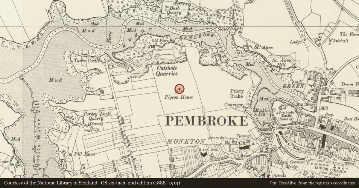
Slide toward Today to fade the historical sheet and see the modern map underneath.
David Rumsey Map Collection, Stanford LibrariesDavid Rumsey Map Collection, Stanford LibrariesDavid Rumsey Map Collection, Stanford LibrariesDavid Rumsey Map Collection, Stanford LibrariesDavid Rumsey Map Collection, Stanford Libraries
5 historical maps cover this location, the earliest the 1636 map "Cornubia : Devonia, Somersetus, Dorcestria, Wiltonia, Glocestria ..." (David Rumsey Map Collection, Stanford Libraries).
Historical maps covering this location
- 1636 · Cornubia : Devonia, Somersetus, Dorcestria, Wiltonia, Glocestria ... (David Rumsey Map Collection, Stanford Libraries)
- 1865 · England and Wales. England No. 6. (David Rumsey Map Collection, Stanford Libraries)
- 1891 · Sheet 10. Ordnance Survey of England and Wales. . (David Rumsey Map Collection, Stanford Libraries)
- 1898 · 245 Pembroke (Hills) (David Rumsey Map Collection, Stanford Libraries)
- 1901 · Sheet 13. (David Rumsey Map Collection, Stanford Libraries)
Cadw's description
Summary description and reason for designation
The monument consists of the remains of a dovecote, dating to the medieval period. A dovecote is a house for doves and pigeons, usually placed at a height above the ground, with openings and provision inside for roosting and breeding.
It is a circular dovecote of stone standing in the centre of a field. The roof is conical and there are two entrances into the structure - one large rectangular one which has been blocked, and one small arched one. Putty holes can be seen in the masonry all round the walls. Some nesting boxes survive within the interior.
The monument is of national importance for its potential to enhance our knowledge of medieval agricultural and settlement organisation. It retains significant archaeological potential, with a strong probability of the presence of associated archaeological features and deposits. The structure itself may be expected to contain archaeological information concerning chronology and building techniques.
The scheduled area comprises the remains described and areas around them within which related evidence may be expected to survive.
Nearby in the register
- Dovecote in field to NW of Priory FarmhouseDomesticunder 1 mi
- Priory Farm CaveCaveunder 1 mi
- Priory FarmhouseDomesticunder 1 mi
- Ruinous Outbuilding to E of Priory FarmhouseAgriculture and Subsistenceunder 1 mi
Other entries of the same register within about three miles of this one, by straight line.