Cof Cymru: National Historic Assets of Wales · Wales
Banc Llwydlos Hut Group
Eglwyswrw, Pembrokeshire, Wales
A scheduled monument in Eglwyswrw, Pembrokeshire, recorded as Enclosed hut circle (Prehistoric).
The record
- Designation
- Scheduled monument
- Site type
- Enclosed hut circle
- Period
- Prehistoric
- Date of designation
- 4 December 1962
- Community
- Eglwyswrw
- Unitary authority
- Pembrokeshire
- Country
- Wales
- Coordinates (centre of the scheduled area)
- 51.96351, -4.77724
- SAM number
- PE370
- Cadw record number
- 2713
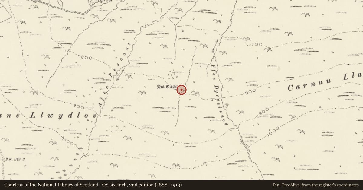
Slide toward Today to fade the historical sheet and see the modern map underneath.
David Rumsey Map Collection, Stanford LibrariesDavid Rumsey Map Collection, Stanford LibrariesDavid Rumsey Map Collection, Stanford LibrariesDavid Rumsey Map Collection, Stanford LibrariesDavid Rumsey Map Collection, Stanford Libraries
5 historical maps cover this location, the earliest the 1636 map "Cornubia : Devonia, Somersetus, Dorcestria, Wiltonia, Glocestria ..." (David Rumsey Map Collection, Stanford Libraries).
Historical maps covering this location
- 1636 · Cornubia : Devonia, Somersetus, Dorcestria, Wiltonia, Glocestria ... (David Rumsey Map Collection, Stanford Libraries)
- 1891 · Sheet 10. Ordnance Survey of England and Wales. . (David Rumsey Map Collection, Stanford Libraries)
- 1898 · 210 Cardigan (Hills) (David Rumsey Map Collection, Stanford Libraries)
- 1898 · 210 Cardigan (Outline) (David Rumsey Map Collection, Stanford Libraries)
- 1901 · Sheet 13. (David Rumsey Map Collection, Stanford Libraries)
Cadw's description
Summary description and reason for designation
The following provides a general description of the Scheduled Ancient Monument.
The monument comprises the remains of an enclosed hut circle settlement, which probably dates from the first millennium BC. The enclosure adjoining a small stream contains two round huts, one in an angle of the wall and another adjoining the entrance. The walls consist of a scatter of stones 3ft wide. To the west is a long hut in the angle of a field wall.
The monument is of national importance for its potential to enhance our knowledge of prehistoric settlement practices. It is an important relic of the prehistoric landscape and retains significant archaeological potential. There is a strong probability of the presence of environmental and structural evidence, including preserved internal and external floor levels.
The scheduled area comprises the remains described and areas around them within which related evidence may be expected to survive.
Nearby in the register
- Foel Feddau Round CairnRound Cairnunder 1 mi
- Tafarn-y-Bwlch Standing StonesStanding Stoneunder 1 mi
- Waun Mawn Standing StonesStanding Stoneunder 1 mi
- Tafarn-y-bwlch Deserted Rural SettlementRectangular hutunder 1 mi
Other entries of the same register within about three miles of this one, by straight line.