Cof Cymru: National Historic Assets of Wales · Wales
Glan-Dwr-Isaf Camp
Nevern, Pembrokeshire, Wales
A scheduled monument in Nevern, Pembrokeshire, recorded as Enclosure (Prehistoric).
The record
- Designation
- Scheduled monument
- Site type
- Enclosure
- Period
- Prehistoric
- Community
- Nevern
- Unitary authority
- Pembrokeshire
- Country
- Wales
- Coordinates (centre of the scheduled area)
- 52.06920, -4.73623
- SAM number
- PE213
- Cadw record number
- 2047
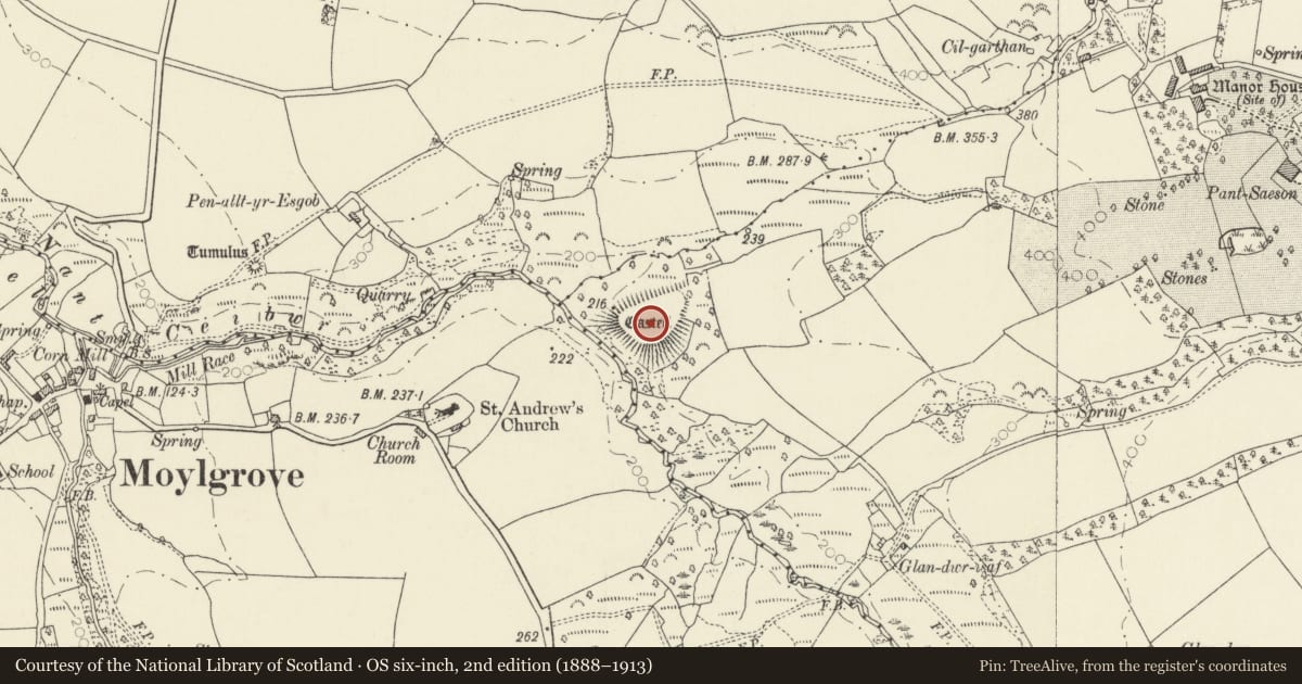
Slide toward Today to fade the historical sheet and see the modern map underneath.
David Rumsey Map Collection, Stanford LibrariesDavid Rumsey Map Collection, Stanford LibrariesDavid Rumsey Map Collection, Stanford LibrariesDavid Rumsey Map Collection, Stanford LibrariesDavid Rumsey Map Collection, Stanford Libraries
5 historical maps cover this location, the earliest the 1608 map "(13) Cambriae Typus." (David Rumsey Map Collection, Stanford Libraries).
Historical maps covering this location
- 1608 · (13) Cambriae Typus. (David Rumsey Map Collection, Stanford Libraries)
- 1636 · Cornubia : Devonia, Somersetus, Dorcestria, Wiltonia, Glocestria ... (David Rumsey Map Collection, Stanford Libraries)
- 1637 · Particular description of Wales. Cambria seu Wallia (David Rumsey Map Collection, Stanford Libraries)
- 1898 · 193 Cardigan (Hills) (David Rumsey Map Collection, Stanford Libraries)
- 1901 · Sheet 13. (David Rumsey Map Collection, Stanford Libraries)
Cadw's description
Summary description and reason for designation
The following provides a general description of the Scheduled Ancient Monument.
The monument comprises the remains of a defended enclosure, which probably dates to the Iron Age period (c. 800 BC - AD 74, the Roman conquest of Wales), and which is set on a promontory above where a feeder stream enters the Nant Ceibwr. It is naturally well defended by steep valley sides to the north, west, south and southeast falling away by 15m. A narrow approach to the promontory on the northeast side is protected by a single rampart. The bank of the rampart rises 3m over the interior and 5m over the ditch. There is a simple entrance through the rampart. The pear-shaped interior measures 90m north east to south west and 30m north west to south east. A depression marking a possible hut circle lies close to the rampart on the southern edge of the interior.
The monument is of national importance for its potential to enhance our knowledge of later prehistoric defensive organisation and settlement. The site forms an important element within the wider later prehistoric context and within the surrounding landscape. The site is well preserved and retains considerable archaeological potential. There is a strong probability of the presence of evidence relating to chronology, building techniques and functional detail.
The scheduled area comprises the remains described and areas around them within which related evidence may be expected to survive.
Nearby in the register
- Church of St AndrewReligious, Ritual and Funeraryunder 1 mi
- Church CottageDomesticunder 1 mi
- Penrallt yr Esgob CairnRound Cairnunder 1 mi
- Plas y MwswmDomesticunder 1 mi
Other entries of the same register within about three miles of this one, by straight line.