Cof Cymru: National Historic Assets of Wales · Wales
Narberth Castle
Narberth, Pembrokeshire, Wales
A scheduled monument in Narberth, Pembrokeshire, recorded as Castle (Medieval).
The record
- Designation
- Scheduled monument
- Site type
- Castle
- Period
- Medieval
- Community
- Narberth
- Unitary authority
- Pembrokeshire
- Country
- Wales
- Coordinates (centre of the scheduled area)
- 51.79613, -4.74238
- SAM number
- PE040
- Cadw record number
- 478
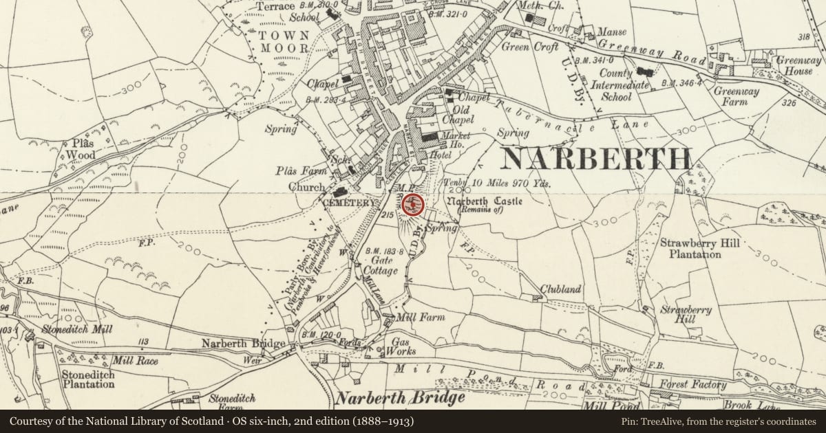
Slide toward Today to fade the historical sheet and see the modern map underneath.
David Rumsey Map Collection, Stanford LibrariesDavid Rumsey Map Collection, Stanford LibrariesDavid Rumsey Map Collection, Stanford LibrariesDavid Rumsey Map Collection, Stanford LibrariesDavid Rumsey Map Collection, Stanford Libraries
5 historical maps cover this location, the earliest the 1636 map "Cornubia : Devonia, Somersetus, Dorcestria, Wiltonia, Glocestria ..." (David Rumsey Map Collection, Stanford Libraries).
Historical maps covering this location
- 1636 · Cornubia : Devonia, Somersetus, Dorcestria, Wiltonia, Glocestria ... (David Rumsey Map Collection, Stanford Libraries)
- 1830 · V.3:11-15:XV. Britisches Reich. A. Kon: England. b. Frstenthum Wales: Shire: 37-40 (David Rumsey Map Collection, Stanford Libraries)
- 1891 · Sheet 10. Ordnance Survey of England and Wales. . (David Rumsey Map Collection, Stanford Libraries)
- 1898 · 228 Haverfordwest (Hills) (David Rumsey Map Collection, Stanford Libraries)
- 1901 · Sheet 13. (David Rumsey Map Collection, Stanford Libraries)
Cadw's description
Summary description and reason for designation
The following provides a general description of the Scheduled Ancient Monument.
The monument consists of the remains of a castle, dating to the medieval period. It is situated at the top of steep-sided spur overlooking the fording point of the Narberth Brook. It comprises a sub rectangular enclosure measuring c 50 m north to south defined by the very fragmentary remains of a masonry curtain wall. There are four cylindrical ‘drum’ towers, one at each corner but only the two southern towers, each of three storeys, survive to any height. Midway along the long west side of the ward are the remains of a small ‘D’-shaped turret and opposite on the east side a larger ‘D’-shaped tower. Against the south curtain wall is a large, unvaulted two-storey Great hall, which forms an ‘L’-shaped block with a two-storey vaulted building against the east curtain. The enclosure was entered from the north over a ditch dividing it form a possible outer ward. The fabric is limestone rubble throughout. Most of the facework has been lost except on the two southern towers. The little dressed stone that survives suggests the defences are from the mid-late 13th century and the domestic buildings are from c 1300 onward.
Underlying earthworks may relate to an initial foundation of the castle in c 1100 but the first record of the castle, when burnt and taken by the Welsh is from 1116. It may have been attacked again in 1159 and was partially destroyed twice by Llewellyn ap Iorerth prince of Gwynedd in 1215 and 1220. Held by Roger Mortimer, Lord of Wigmore from 1247 it was completely destroyed in 1257 during the rising of the Welsh under Llywelyn ap Gruffudd. Likely to have remained entirely of timber throughout this period the castle it was then probably Mortimer who rebuilt it in stone with repair work after a minor attack of 1299 providing a context for the domestic buildings as the Great Hall has widow detail of a broadly late 13th-early 14th century date. An inventory of the castle survives from 1330 though by 1424 it was recorded as in decay. Passing through a succession of families including episodes of being held by the crown it continued to decline though a detailed survey of 1539 shows it to have been fully occupied. Manorial courts were held into the castle well into the 16th century and the castle was finally abandoned sometime after 1677.
The monument is of national importance for its potential to enhance our knowledge of medieval defensive practices. The monument is well-preserved and an important relic of the medieval landscape. It retains significant archaeological potential, with a strong probability of the presence of both structural evidence and intact associated deposits.
The scheduled area comprises the remains described and areas around them within which related evidence may be expected to survive.
Nearby in the register
- Narbeth CastleDefenceunder 1 mi
- Milestone by entrance to New CemeteryTransportunder 1 mi
- The Rutzen Arms P.H.Commercialunder 1 mi
- 12 Market SquareDomesticunder 1 mi
Other entries of the same register within about three miles of this one, by straight line.