Cof Cymru: National Historic Assets of Wales · Wales
St Arvan's Church Cross-slab
St. Arvans, Monmouthshire, Wales
A scheduled monument in St. Arvans, Monmouthshire, recorded as Cross-marked stone (Early Medieval).
The record
- Designation
- Scheduled monument
- Site type
- Cross-marked stone
- Period
- Early Medieval
- Date of designation
- 11 March 2011
- Community
- St. Arvans
- Unitary authority
- Monmouthshire
- Country
- Wales
- Coordinates (centre of the scheduled area)
- 51.66534, -2.70042
- SAM number
- MM355
- Cadw record number
- 1327
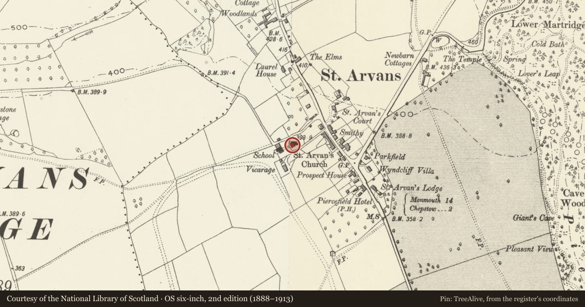
Slide toward Today to fade the historical sheet and see the modern map underneath.
David Rumsey Map Collection, Stanford LibrariesDavid Rumsey Map Collection, Stanford LibrariesDavid Rumsey Map Collection, Stanford LibrariesDavid Rumsey Map Collection, Stanford LibrariesDavid Rumsey Map Collection, Stanford Libraries
5 historical maps cover this location, the earliest the 1636 map "Cornubia : Devonia, Somersetus, Dorcestria, Wiltonia, Glocestria ..." (David Rumsey Map Collection, Stanford Libraries).
Historical maps covering this location
- 1636 · Cornubia : Devonia, Somersetus, Dorcestria, Wiltonia, Glocestria ... (David Rumsey Map Collection, Stanford Libraries)
- 1830 · V.3:11-15:XV.Britisches Reich. A. Kon: England. a. England ab sich: Shire:15-17, 33 (David Rumsey Map Collection, Stanford Libraries)
- 1895 · Sheet 11. Ordnance Survey of England and Wales. (David Rumsey Map Collection, Stanford Libraries)
- 1897 · 250 Chepstow (Outline) (David Rumsey Map Collection, Stanford Libraries)
- 1905 · 250 Chepstow (Hills) (David Rumsey Map Collection, Stanford Libraries)
Cadw's description
Summary description and reason for designation
The following provides a general description of the Scheduled Ancient Monument.
The monument comprises a cross-slab, which probably dates to the late tenth or early eleventh century AD. Found during the restoration of the church during the 1880s, the sandstone cross-slab is now displayed on a free-standing plinth at the W end of the S aisle of St Arvan’s church. The top part including the upper cross arm is missing. The remaining slab was originally in two pieces, but has been re-joined following conservation work and measures 0.91m in height, 0.44m in width and 0.15m in depth. The shaped rectangular stone is decorated on all sides in low relief with plain edge-moulding. The principal face features a Latin ring-cross with square arms and small circular arm-pits set above a central shaft of plaitwork with a vertical series of four panels depicting flying, robed figures to each side. The reverse face features a similar Latin ring-cross to the principal face, but set above an undecorated shaft with vertical panels of interlace to each side. The bottom of the shaft is interrupted by a pair of opposed symmetrical seated figures in profile. The face of one edge is decorated with a vertical band of T-fret.
The monument is of national importance for its potential to enhance our knowledge of the early medieval period in Wales (c. AD 400 – 1100) for which this class of monument forms one of the most important sources of evidence. It forms an important element within the wider early medieval landscape, providing important evidence for this formative period of Welsh history, particularly concerning the origins and evolution of Christianity, the development of stylistic traditions and carved stone production.
The area scheduled comprises the remains described. It is square in shape on plan and measures 1m N-S by 1m transversely.
Nearby in the register
- Church of St ArvanReligious, Ritual and Funeraryunder 1 mi
- Sycamore LodgeEducationunder 1 mi
- St. Arvans CourtDomesticunder 1 mi
- Village FountainWater Supply and Drainageunder 1 mi
Other entries of the same register within about three miles of this one, by straight line.