Cof Cymru: National Historic Assets of Wales · Wales
Blorenge Quarries Tramroad
Llanfoist Fawr, Monmouthshire, Wales
A scheduled monument in Llanfoist Fawr, Monmouthshire, recorded as Tramroad (Post Medieval/Modern).
The record
- Designation
- Scheduled monument
- Site type
- Tramroad
- Period
- Post Medieval/Modern
- Date of designation
- 21 November 2000
- Community
- Llanfoist Fawr
- Unitary authority
- Monmouthshire
- Country
- Wales
- Coordinates (centre of the scheduled area)
- 51.79949, -3.06839
- SAM number
- MM288
- Cadw record number
- 1061
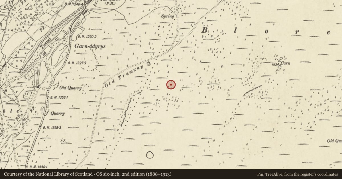
Slide toward Today to fade the historical sheet and see the modern map underneath.
David Rumsey Map Collection, Stanford LibrariesDavid Rumsey Map Collection, Stanford LibrariesDavid Rumsey Map Collection, Stanford LibrariesDavid Rumsey Map Collection, Stanford LibrariesDavid Rumsey Map Collection, Stanford Libraries
5 historical maps cover this location, the earliest the 1608 map "(13) Cambriae Typus." (David Rumsey Map Collection, Stanford Libraries).
Historical maps covering this location
- 1608 · (13) Cambriae Typus. (David Rumsey Map Collection, Stanford Libraries)
- 1856 · 42. Brecon. (David Rumsey Map Collection, Stanford Libraries)
- 1898 · 232 Abergavenny (Hills) (David Rumsey Map Collection, Stanford Libraries)
- 1898 · 232 Abergavenny (Outline) (David Rumsey Map Collection, Stanford Libraries)
- 1901 · Sheet 14. (David Rumsey Map Collection, Stanford Libraries)
Cadw's description
Summary description and reason for designation
The following provides a general description of the Scheduled Ancient Monument.
The monument consists of the remains of a tramroad, dating to the 18th century and is one of the earliest primitive railways associated with the Blaenavon Iron Company. The tramroad was built c. 1795 to bring limestone from quarries at the northern end of the Blorenge to the Ironworks. The quarry appears to have failed due to the steep dip of the limestone, and the tramroad fell out of use in 1804. The plateway track was removed by 1813. The remains include the terminal quarry and limekilns.
The monument is of national importance for its potential to enhance our knowledge of the development of industrial transportation in the 18th and 19th century. The track bed, bridges, drainage systems, embankments and revetments may all be expected to contain archaeological information in regard to construction techniques and functional detail.
The scheduled area comprises the remains described and areas around them within which related evidence may be expected to survive.
Nearby in the register
- Cairn on the BlorengeRound Cairnunder 1 mi
- Garnddyrys Ironworks (Site of) and adjacent TramwayIronworksunder 1 mi
- Blorenge Tunnel, Hill's TramroadTramroadunder 1 mi
- Pwll Du Limestone Quarry & Water Balance LiftQuarryunder 1 mi
Other entries of the same register within about three miles of this one, by straight line.