Cof Cymru: National Historic Assets of Wales · Wales
The Giant's Cave, Piercefield
St. Arvans, Monmouthshire, Wales
A scheduled monument in St. Arvans, Monmouthshire, recorded as Cave (Post Medieval/Modern).
The record
- Designation
- Scheduled monument
- Site type
- Cave
- Period
- Post Medieval/Modern
- Date of designation
- 4 August 2000
- Community
- St. Arvans
- Unitary authority
- Monmouthshire
- Country
- Wales
- Coordinates (centre of the scheduled area)
- 51.66331, -2.68878
- SAM number
- MM282
- Cadw record number
- 850
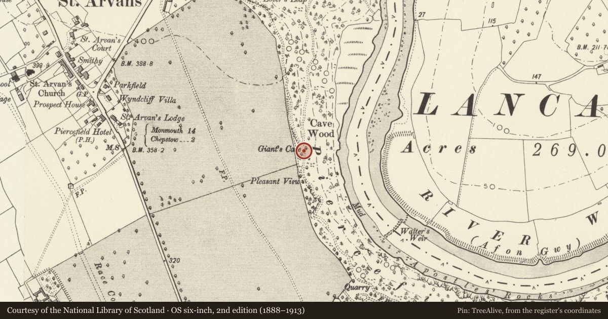
Slide toward Today to fade the historical sheet and see the modern map underneath.
David Rumsey Map Collection, Stanford LibrariesDavid Rumsey Map Collection, Stanford LibrariesDavid Rumsey Map Collection, Stanford LibrariesDavid Rumsey Map Collection, Stanford LibrariesDavid Rumsey Map Collection, Stanford Libraries
5 historical maps cover this location, the earliest the 1608 map "(13) Cambriae Typus." (David Rumsey Map Collection, Stanford Libraries).
Historical maps covering this location
- 1608 · (13) Cambriae Typus. (David Rumsey Map Collection, Stanford Libraries)
- 1636 · Cornubia : Devonia, Somersetus, Dorcestria, Wiltonia, Glocestria ... (David Rumsey Map Collection, Stanford Libraries)
- 1895 · Sheet 11. Ordnance Survey of England and Wales. (David Rumsey Map Collection, Stanford Libraries)
- 1897 · 250 Chepstow (Outline) (David Rumsey Map Collection, Stanford Libraries)
- 1905 · 250 Chepstow (Hills) (David Rumsey Map Collection, Stanford Libraries)
Cadw's description
Summary description and reason for designation
The following provides a general description of the Scheduled Ancient Monument.
The monument consists of a cave, partly natural but adapted as a principal feature of the famous 18th century Piercefield Walks. Giant’s Cave is a curving tunnel, cut into the rock-face through which the walk passes. The cave comprises a partially natural main chamber, with subsidiary chambers to the east. At the southern entrance is a bastion defined by low walling. The bastion outside the cave gives added interest as the point from which echo effects were created using mounted guns to fire across the Wye Valley. A statue of a giant once stood above one of the entrances.
The monument is of national importance for its potential to enhance our knowledge of prehistoric settlement, ritual and funerary practices. It retains significant archaeological potential, with a strong probability of the presence of associated archaeological features and deposits.
The scheduled area comprises the remains described and areas around them within which related evidence may be expected to survive.
Nearby in the register
- Walls of Walled Garden and attached Bothies and Cottage at Piercefield ParkDomesticunder 1 mi
- Milestone set in the Boundary Wall of Chepstow Racecourse (Piercefield Park)Transportunder 1 mi
- The Cold Bath: PiercefieldBath Houseunder 1 mi
- Wall and Gatepiers (known as Temple Doors) to Piercefield Park at The WyndcliffDomesticunder 1 mi
Other entries of the same register within about three miles of this one, by straight line.