Cof Cymru: National Historic Assets of Wales · Wales
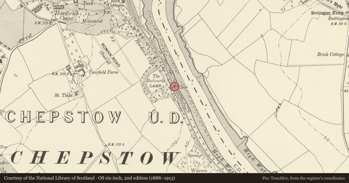
St Peter's Cave
Chepstow, Monmouthshire, Wales
A scheduled monument in Chepstow, Monmouthshire, recorded as Cave (Prehistoric).
The record
- Designation
- Scheduled monument
- Site type
- Cave
- Period
- Prehistoric
- Date of designation
- 28 May 1965
- Community
- Chepstow
- Unitary authority
- Monmouthshire
- Country
- Wales
- Coordinates (centre of the scheduled area)
- 51.63127, -2.66769
- SAM number
- MM160
- Cadw record number
- 576
Slide toward Today to fade the historical sheet and see the modern map underneath.
David Rumsey Map Collection, Stanford LibrariesDavid Rumsey Map Collection, Stanford LibrariesDavid Rumsey Map Collection, Stanford LibrariesDavid Rumsey Map Collection, Stanford LibrariesDavid Rumsey Map Collection, Stanford Libraries
5 historical maps cover this location, the earliest the 1636 map "Cornubia : Devonia, Somersetus, Dorcestria, Wiltonia, Glocestria ..." (David Rumsey Map Collection, Stanford Libraries).
Historical maps covering this location
- 1636 · Cornubia : Devonia, Somersetus, Dorcestria, Wiltonia, Glocestria ... (David Rumsey Map Collection, Stanford Libraries)
- 1830 · V.3:11-15:XV.Britisches Reich. A. Kon: England. a. England ab sich: Shire:15-17, 33 (David Rumsey Map Collection, Stanford Libraries)
- 1895 · Sheet 11. Ordnance Survey of England and Wales. (David Rumsey Map Collection, Stanford Libraries)
- 1897 · 250 Chepstow (Outline) (David Rumsey Map Collection, Stanford Libraries)
- 1905 · 250 Chepstow (Hills) (David Rumsey Map Collection, Stanford Libraries)
Cadw's description
Summary description and reason for designation
The following provides a general description of the Scheduled Ancient Monument.
The monument consists of a cave containing archaeological deposits that can date from as early as the Palaeolithic period. A cave may have been used for occupation, storage, burial, refuse, or as a temporary shelter. St Peter's Cave is located in a limestone cliff on the left bank of the River Wye, immediately below the railway line. The south west facing entrance is 3m high and 4.5m wide. The cave passage extends to approximately 21m and varies in height between 1.5m and 3m. The evidence of charcoal deposits suggests prehistoric activity.
The monument is of national importance for its potential to enhance our knowledge of prehistoric settlement, ritual and funerary practices. It retains significant archaeological potential, with a strong probability of the presence of associated archaeological features and deposits.
The scheduled area comprises the remains described and areas around them within which related evidence may be expected to survive.
Nearby in the register
- Bulwarks Prehistoric EnclosureHillfortunder 1 mi
- Cemetery LodgeReligious, Ritual and Funeraryunder 1 mi
- Cemetery ChapelReligious, Ritual and Funeraryunder 1 mi
- Footbridge at Chepstow StationTransportunder 1 mi
Other entries of the same register within about three miles of this one, by straight line.