Cof Cymru: National Historic Assets of Wales · Wales
Lower House Camp
Berriew, Powys, Wales
A scheduled monument in Berriew, Powys, recorded as Enclosure (Prehistoric).
The record
- Designation
- Scheduled monument
- Site type
- Enclosure
- Period
- Prehistoric
- Community
- Berriew
- Unitary authority
- Powys
- Country
- Wales
- Coordinates (centre of the scheduled area)
- 52.62295, -3.22773
- SAM number
- MG154
- Cadw record number
- 2642
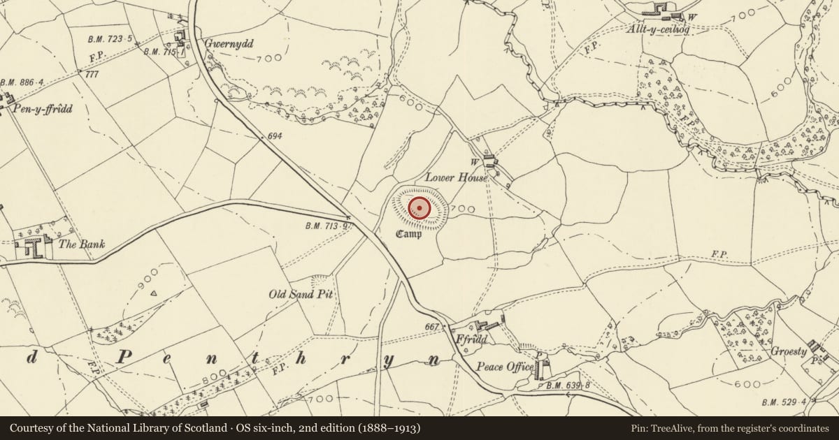
Slide toward Today to fade the historical sheet and see the modern map underneath.
David Rumsey Map Collection, Stanford LibrariesDavid Rumsey Map Collection, Stanford LibrariesDavid Rumsey Map Collection, Stanford LibrariesDavid Rumsey Map Collection, Stanford LibrariesLlyfrgell Genedlaethol Cymru – The National Library of Wales
5 historical maps cover this location, the earliest the 1795 map "To Sir Watkin Williams-Wynn Bart ... the map of the six counties of North Wales is most humbly inscribed by his obedient humble servant" (Llyfrgell Genedlaethol Cymru – The National Library of Wales).
Historical maps covering this location
- 1795 · To Sir Watkin Williams-Wynn Bart ... the map of the six counties of North Wales is most… (Llyfrgell Genedlaethol Cymru – The National Library of Wales)
- 1883 · Watershed map England, Wales 3. (David Rumsey Map Collection, Stanford Libraries)
- 1899 · 151 Welshpool (Hills) (David Rumsey Map Collection, Stanford Libraries)
- 1901 · Sheet 9 and 10. (David Rumsey Map Collection, Stanford Libraries)
- 1916 · Sheet 60. Shrewsbury. (David Rumsey Map Collection, Stanford Libraries)
Cadw's description
Summary description and reason for designation
The following provides a description of the Scheduled Ancient Monument.
The monument consists of the remains of a defended enclosure surrounded by three banks and ditches probably dating to the Iron Age (c. 800 BC - AD 74). The enclosure is sub-oval in plan, with a probable entrance in the north-west. Such enclosures are thought to have contained farmsteads with roundhouses and associated ancillary structures, and to have been designed to safeguard and manage stock.
The monument is of national importance for its potential to enhance our knowledge of later prehistoric defensive organisation and settlement. The site forms an important element within the wider later prehistoric context and within the surrounding landscape. The site is well preserved and retains considerable archaeological potential. There is a strong probability of the presence of evidence relating to chronology, layout, building techniques and functional detail.
The scheduled area comprises the remains described and areas around them within which related evidence may be expected to survive.
Nearby in the register
- Camp 270m SSW of Ty MawrEnclosureunder 1 mi
- Ty MawrDomesticunder 1 mi
- Plas Yr Alarch Moated SiteMoated Siteunder 1 mi
- Trefnant HallDomesticunder 1 mi
Other entries of the same register within about three miles of this one, by straight line.