Cof Cymru: National Historic Assets of Wales · Wales
Newtown Old Church
Newtown and Llanllwchaiarn, Powys, Wales
A scheduled monument in Newtown and Llanllwchaiarn, Powys, recorded as Church (Medieval).
The record
- Designation
- Scheduled monument
- Site type
- Church
- Period
- Medieval
- Community
- Newtown and Llanllwchaiarn
- Unitary authority
- Powys
- Country
- Wales
- Coordinates (centre of the scheduled area)
- 52.51685, -3.31461
- SAM number
- MG056
- Cadw record number
- 722
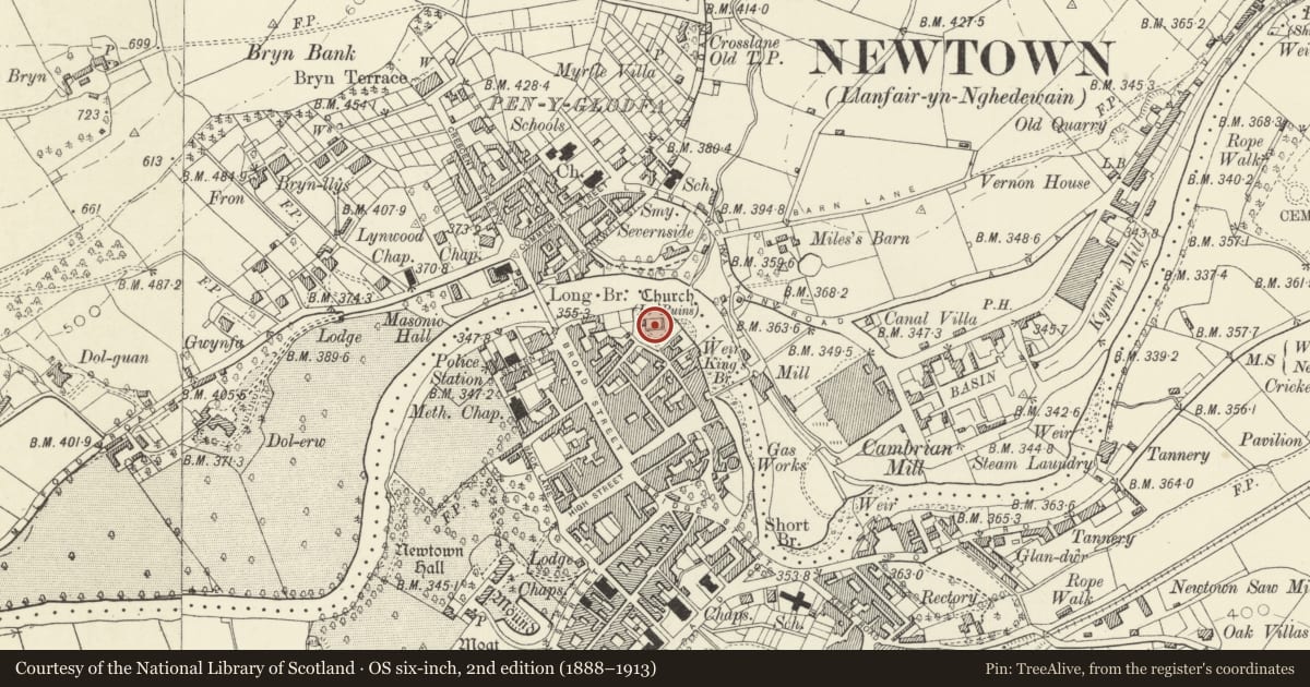
Slide toward Today to fade the historical sheet and see the modern map underneath.
David Rumsey Map Collection, Stanford LibrariesDavid Rumsey Map Collection, Stanford LibrariesDavid Rumsey Map Collection, Stanford LibrariesDavid Rumsey Map Collection, Stanford LibrariesLlyfrgell Genedlaethol Cymru – The National Library of Wales
5 historical maps cover this location, the earliest the 1637 map "Particular description of Wales. Cambria seu Wallia" (David Rumsey Map Collection, Stanford Libraries).
Historical maps covering this location
- 1637 · Particular description of Wales. Cambria seu Wallia (David Rumsey Map Collection, Stanford Libraries)
- 1795 · To Sir Watkin Williams-Wynn Bart ... the map of the six counties of North Wales is most… (Llyfrgell Genedlaethol Cymru – The National Library of Wales)
- 1883 · Watershed map England, Wales 3. (David Rumsey Map Collection, Stanford Libraries)
- 1899 · 165 Montgomery (Hills) (David Rumsey Map Collection, Stanford Libraries)
- 1901 · Sheet 14. (David Rumsey Map Collection, Stanford Libraries)
Cadw's description
Summary description and reason for designation
The following provides a general description of the scheduled monument.
The monument comprises the remains of a church, probably dating to the medieval period. The tower and south and east walls stand to full height, and have all been renovated. The memorial to the Pryce family stands in interior on E side, near the altar. The interior is grassed over with cleared grave-stones from churchyard arranged around walls.
The monument is of national importance for its potential to enhance our knowledge of medieval ecclesiastical organisation. The monument forms an important element within the wider medieval context and the structure itself may be expected to contain archaeological information in regard to chronology, building techniques and functional detail.
The scheduled area comprises the remains described and areas around them within which related evidence may be expected to survive.
Nearby in the register
- Gate's, Gate Piers and Walls around the perimeter of St Mary's ChurchyardReligious, Ritual and Funeraryunder 1 mi
- Tomb of Robert Owen, including RailingsReligious, Ritual and Funeraryunder 1 mi
- Former Parish Church of St Mary and Pryce MausoleumReligious, Ritual and Funeraryunder 1 mi
- 11 Old Church StreetDomesticunder 1 mi
Other entries of the same register within about three miles of this one, by straight line.