Cof Cymru: National Historic Assets of Wales · Wales
Caersws Roman Site
Caersws, Powys, Wales
A scheduled monument in Caersws, Powys, recorded as Fort (Roman).
The record
- Designation
- Scheduled monument
- Site type
- Fort
- Period
- Roman
- Community
- Caersws
- Unitary authority
- Powys
- Country
- Wales
- Coordinates (centre of the scheduled area)
- 52.51777, -3.43122
- SAM number
- MG001
- Cadw record number
- 1969
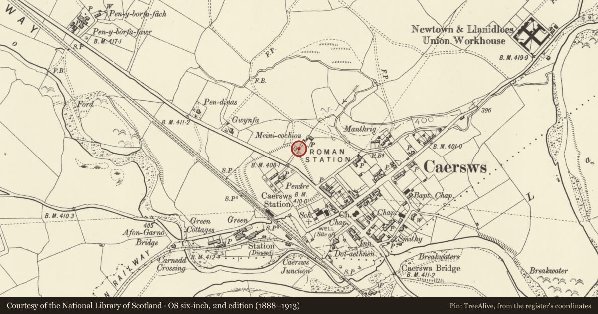
Slide toward Today to fade the historical sheet and see the modern map underneath.
David Rumsey Map Collection, Stanford LibrariesDavid Rumsey Map Collection, Stanford LibrariesDavid Rumsey Map Collection, Stanford LibrariesDavid Rumsey Map Collection, Stanford LibrariesDavid Rumsey Map Collection, Stanford Libraries
5 historical maps cover this location, the earliest the 1608 map "(13) Cambriae Typus." (David Rumsey Map Collection, Stanford Libraries).
Historical maps covering this location
- 1608 · (13) Cambriae Typus. (David Rumsey Map Collection, Stanford Libraries)
- 1637 · Particular description of Wales. Cambria seu Wallia (David Rumsey Map Collection, Stanford Libraries)
- 1883 · Watershed map England, Wales 3. (David Rumsey Map Collection, Stanford Libraries)
- 1899 · 164 Llanidloes (Hills) (David Rumsey Map Collection, Stanford Libraries)
- 1901 · Sheet 14. (David Rumsey Map Collection, Stanford Libraries)
Cadw's description
Summary description and reason for designation
The following provides a general description of the scheduled monument.
The monument comprises buried features and earthworks representing a Roman fort. The primary Roman fort network was designed and constructed by the Roman army for the purpose of military conquest and rule. Excavations have produced evidence of 3 district phases of construction from
Pre-Flavian-Antonine Periods.
The monument is of national importance for its potential to enhance our knowledge of Roman military organisation. The monument forms an important element within the wider context of the Roman occupation of Wales and the structures may contain well preserved archaeological evidence concerning chronology, layout and building techniques.
The scheduled area comprises the remains described and areas around them within which related evidence may be expected to survive.
Nearby in the register
- Caersws Railway Station, with Stationmaster's HouseTransportunder 1 mi
- Signal Box at Caersws Railway StationTransportunder 1 mi
- Caersws Roman Fort: Section of South Western DefencesFortunder 1 mi
- Caersws Roman Fort and Vicus: section in southern part of vicusVicusunder 1 mi
Other entries of the same register within about three miles of this one, by straight line.