Cof Cymru: National Historic Assets of Wales · Wales
The Salthouse, Port Eynon
Port Eynon, Swansea, Wales
A scheduled monument in Port Eynon, Swansea, recorded as Salt Works (Post Medieval/Modern).
The record
- Designation
- Scheduled monument
- Site type
- Salt Works
- Period
- Post Medieval/Modern
- Date of designation
- 30 January 1995
- Community
- Port Eynon
- Unitary authority
- Swansea
- Country
- Wales
- Coordinates (centre of the scheduled area)
- 51.53981, -4.20843
- SAM number
- GM471
- Cadw record number
- 3735
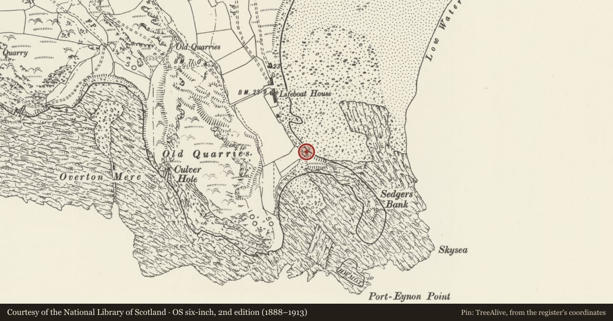
Slide toward Today to fade the historical sheet and see the modern map underneath.
David Rumsey Map Collection, Stanford LibrariesUniversity Library, Vrije Universiteit AmsterdamDavid Rumsey Map Collection, Stanford LibrariesUniversity Library, Vrije Universiteit AmsterdamDavid Rumsey Map Collection, Stanford Libraries
5 historical maps cover this location, the earliest the 1608 map "(13) Cambriae Typus." (David Rumsey Map Collection, Stanford Libraries).
Historical maps covering this location
- 1608 · (13) Cambriae Typus. (David Rumsey Map Collection, Stanford Libraries)
- 1636 · Cornubia : Devonia, Somersetus, Dorcestria, Wiltonia, Glocestria ... (David Rumsey Map Collection, Stanford Libraries)
- 1891 · Sheet 10. Ordnance Survey of England and Wales. . (David Rumsey Map Collection, Stanford Libraries)
- Sheet 7 South Wales (University Library, Vrije Universiteit Amsterdam)
- [Kaart] (University Library, Vrije Universiteit Amsterdam)
Cadw's description
Summary description and reason for designation
The following provides a general description of the Scheduled Ancient Monument.
This monument comprises the remains of a group of structures on the sea-edge, the site of a 16th - early 17th century salthouse and fortified house. Used in the 19th century as oysterman's cottages, the site is divided into a series of three stone lined chambers at beach level, and a group of two storey buildings at higher level. The largest chamber produced on excavation the remains of a wooden pump, 1.75m long, comprising a hollowed out tree trunk with non-return valve. This is still in-situ. Sea water was fed into these chambers at high tide and pumped to the higher level to be evaporated in coal-fired furnaces to make salt. The buildings have possible musket loops.
The monument is of national importance for its potential to enhance our knowledge of early salt-making processes. Indeed, this saltworks represents the most intact example of its kind in south Wales. The monument retains significant archaeological potential and forms an important element in the wider south-Wales industrial landscape.
The area scheduled comprises the remains described and an area around them within which related evidence may be expected to survive.
Nearby in the register
- Culver Hole Dovecotdovecoteunder 1 mi
- The Culver HoleMiscellaneousunder 1 mi
- Lifeboatmen's Memorial at south east corner of St Cattwg's churchyardCommemorativeunder 1 mi
- Overton HouseDomesticunder 1 mi
Other entries of the same register within about three miles of this one, by straight line.