Cof Cymru: National Historic Assets of Wales · Wales
Earthwork 450m SW of Llanddewi Church
Port Eynon, Swansea, Wales
A scheduled monument in Port Eynon, Swansea, recorded as Enclosure (Prehistoric).
The record
- Designation
- Scheduled monument
- Site type
- Enclosure
- Period
- Prehistoric
- Community
- Port Eynon
- Unitary authority
- Swansea
- Country
- Wales
- Coordinates (centre of the scheduled area)
- 51.57671, -4.22982
- SAM number
- GM334
- Cadw record number
- 1012
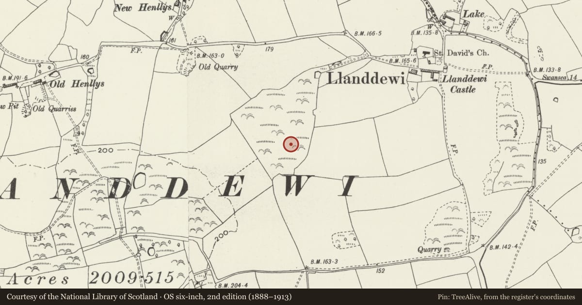
Slide toward Today to fade the historical sheet and see the modern map underneath.
David Rumsey Map Collection, Stanford LibrariesDavid Rumsey Map Collection, Stanford LibrariesDavid Rumsey Map Collection, Stanford LibrariesDavid Rumsey Map Collection, Stanford LibrariesDavid Rumsey Map Collection, Stanford Libraries
5 historical maps cover this location, the earliest the 1636 map "Cornubia : Devonia, Somersetus, Dorcestria, Wiltonia, Glocestria ..." (David Rumsey Map Collection, Stanford Libraries).
Historical maps covering this location
- 1636 · Cornubia : Devonia, Somersetus, Dorcestria, Wiltonia, Glocestria ... (David Rumsey Map Collection, Stanford Libraries)
- 1865 · England and Wales. England No. 6. (David Rumsey Map Collection, Stanford Libraries)
- 1891 · Sheet 10. Ordnance Survey of England and Wales. . (David Rumsey Map Collection, Stanford Libraries)
- 1907 · 246 Worms Head (Hills) (David Rumsey Map Collection, Stanford Libraries)
- 1920 · Sheet 100. Llanelly. (David Rumsey Map Collection, Stanford Libraries)
Cadw's description
Summary description and reason for designation
The following provides a general description of the Scheduled Ancient Monument.
The monument comprises the remains of a prehistoric rectilinear earthwork enclosure. It measures 64.0m east-west by 66.0m transversely and is sub-square in plan, the west side being slightly curved, but the other sides straight with rounded corners. The outer bank is approximately 10.0m wide and less than 0.2m high internally. The ditch, 10.0m wide and up to 0.3m deep, with the bank standing 0.7m above the base of the ditch. The entrance was in the east half of the north side. The site has been much reduced and spread by ploughing.
This monument is of national importance for its potential to enhance our knowledge of prehistoric domestic life, social organisation and defensive practices.
The scheduled area comprises the remains described and areas around them which related evidence may be expected to survive.
Nearby in the register
- Church of St DavidReligious, Ritual and Funeraryunder 1 mi
- Old HenllysDomesticunder 1 mi
- Providence Baptist Chapel and attached ManseReligious, Ritual and Funeraryunder 1 mi
- Newton henge, cropmarkHengeunder 1 mi
Other entries of the same register within about three miles of this one, by straight line.