Cof Cymru: National Historic Assets of Wales · Wales
Pillar-Cross in Llandough Churchyard
Llandough, Vale of Glamorgan, Wales
A scheduled monument in Llandough, Vale of Glamorgan, recorded as Cross (Early Medieval).
The record
- Designation
- Scheduled monument
- Site type
- Cross
- Period
- Early Medieval
- Date of designation
- 9 January 1951
- Community
- Llandough
- Unitary authority
- Vale of Glamorgan
- Country
- Wales
- Coordinates (centre of the scheduled area)
- 51.45218, -3.19879
- SAM number
- GM209
- Cadw record number
- 3695
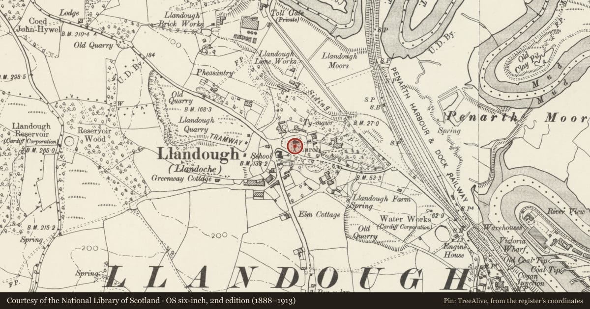
Slide toward Today to fade the historical sheet and see the modern map underneath.
David Rumsey Map Collection, Stanford LibrariesDavid Rumsey Map Collection, Stanford LibrariesDavid Rumsey Map Collection, Stanford LibrariesDavid Rumsey Map Collection, Stanford LibrariesDavid Rumsey Map Collection, Stanford Libraries
5 historical maps cover this location, the earliest the 1636 map "Cornubia : Devonia, Somersetus, Dorcestria, Wiltonia, Glocestria ..." (David Rumsey Map Collection, Stanford Libraries).
Historical maps covering this location
- 1636 · Cornubia : Devonia, Somersetus, Dorcestria, Wiltonia, Glocestria ... (David Rumsey Map Collection, Stanford Libraries)
- 1637 · The fourth table of England. Cornub. Devonia, Somerset etc. (David Rumsey Map Collection, Stanford Libraries)
- 1865 · England and Wales. England No. 6. (David Rumsey Map Collection, Stanford Libraries)
- 1898 · 263 Cardiff (Hills) (David Rumsey Map Collection, Stanford Libraries)
- 1913 · Sheet 110. Cardiff & Mouth of the Severn. (David Rumsey Map Collection, Stanford Libraries)
Cadw's description
Summary description and reason for designation
The following provides a general description of the Scheduled Ancient Monument.
The monument consists of the remains of a free standing cross probably dating to the early medieval or medieval period, which is situated on the south side of the church. It stands 2.8m high and is rectangular with its longest side orientated north-south. The base of the cross is 0.5m high, 0.9m long and 0.5m wide and slightly tapering towards the top. The sides of the base are each carved: on the west a horse and rider, 5 'columns' on the east, a head and shoulders on the south and a head and shoulders on the north. On top of the base is a slightly bulging pillar, which measures 1.15m in height, 0.5m width and 0.4m depth; it is decorated with rounded columns at the corners and has an interlaced pattern of plaitwork on these columns and on its east and west faces. On top of this column is a stone cushion with horizontal bands of decoration. On top of the cushion is a small section of cross shaft, 0.7m high and 0.3m long and wide. At the corners are four rounded columns which are undecorated but the area between these column is decorated with an interlaced plaitwork pattern which is slightly different on each side.
The monument is of national importance for its potential to enhance our knowledge of the organisation and practice of Christianity. It retains significant archaeological potential, with a strong probability of the presence of associated archaeological features and deposits. A cross may be part of a larger cluster of monuments and their importance can further enhanced by their group value.
The scheduled area comprises the remains described and areas around them within which related evidence may be expected to survive.
Nearby in the register
- Church of St DochdwyReligious, Ritual and Funeraryunder 1 mi
- Pound CottageDomesticunder 1 mi
- Former National School and School-houseEducationunder 1 mi
- Former Cardiff and District Western District Sewerage Pumping Station.Water Supply and Drainageunder 1 mi
Other entries of the same register within about three miles of this one, by straight line.