Cof Cymru: National Historic Assets of Wales · Wales
Nottage Court Inscribed Stone
Porthcawl, Bridgend, Wales
A scheduled monument in Porthcawl, Bridgend, recorded as Inscribed Stone (Roman).
The record
- Designation
- Scheduled monument
- Site type
- Inscribed Stone
- Period
- Roman
- Community
- Porthcawl
- Unitary authority
- Bridgend
- Country
- Wales
- Coordinates (centre of the scheduled area)
- 51.49001, -3.70050
- SAM number
- GM040
- Cadw record number
- 3382
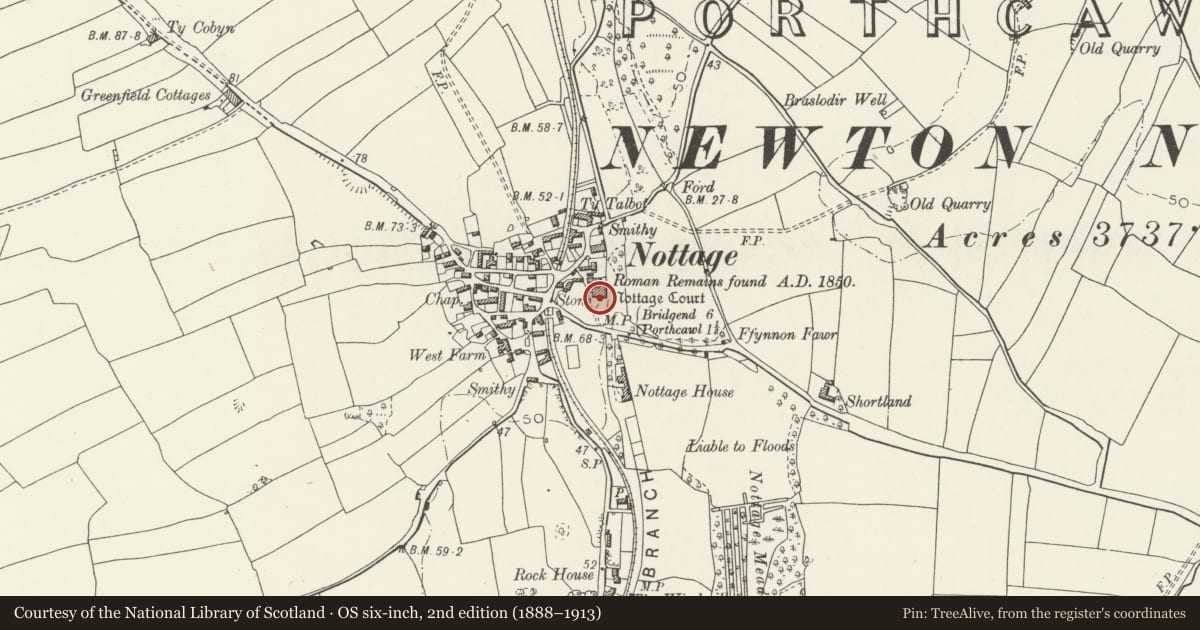
Slide toward Today to fade the historical sheet and see the modern map underneath.
David Rumsey Map Collection, Stanford LibrariesDavid Rumsey Map Collection, Stanford LibrariesDavid Rumsey Map Collection, Stanford LibrariesDavid Rumsey Map Collection, Stanford LibrariesDavid Rumsey Map Collection, Stanford Libraries
5 historical maps cover this location, the earliest the 1636 map "Cornubia : Devonia, Somersetus, Dorcestria, Wiltonia, Glocestria ..." (David Rumsey Map Collection, Stanford Libraries).
Historical maps covering this location
- 1636 · Cornubia : Devonia, Somersetus, Dorcestria, Wiltonia, Glocestria ... (David Rumsey Map Collection, Stanford Libraries)
- 1637 · The fourth table of England. Cornub. Devonia, Somerset etc. (David Rumsey Map Collection, Stanford Libraries)
- 1865 · England and Wales. England No. 6. (David Rumsey Map Collection, Stanford Libraries)
- 1897 · 262 Pontypridd (Hills) (David Rumsey Map Collection, Stanford Libraries)
- 1897 · 262 Pontypridd (Outline) (David Rumsey Map Collection, Stanford Libraries)
Cadw's description
Summary description and reason for designation
The following provides a general description of the Scheduled Ancient Monument.
The monument consists of an inscribed stone probably dating to the Roman period.
The stone stands 1.1m high by 0.3m-0.4m wide and 0.2m-0.3m deep. On its east side there is an inscription in three lines towards the top of the stone. There appears to be nothing on the west or north sides, but on the south side there are some very faint markings. The stone may also have later Ogham markings.
The monument is of national importance for its potential to enhance our knowledge of the organisation of Roman everyday life and ritual practices. It retains significant archaeological potential, with a strong probability of the presence of associated archaeological features and deposits. An inscribed stone may be part of a larger cluster of monuments and their importance can further enhanced by their group value.
The scheduled area comprises the remains described and areas around them within which related evidence may be expected to survive.
Nearby in the register
- Nottage CourtDomesticunder 1 mi
- The Farmers' ArmsCommercialunder 1 mi
- Nottage HouseDomesticunder 1 mi
- Ffynnon FawrWater Supply and Drainageunder 1 mi
Other entries of the same register within about three miles of this one, by straight line.