Cof Cymru: National Historic Assets of Wales · Wales
Merthyr Mawr Inscribed Stones (now in St Rogue's Chapel)
Merthyr Mawr, Bridgend, Wales
A scheduled monument in Merthyr Mawr, Bridgend, recorded as Cross (Medieval).
The record
- Designation
- Scheduled monument
- Site type
- Cross
- Period
- Medieval
- Date of designation
- 4 July 1956
- Community
- Merthyr Mawr
- Unitary authority
- Bridgend
- Country
- Wales
- Coordinates (centre of the scheduled area)
- 51.49075, -3.60205
- SAM number
- GM026
- Cadw record number
- 2233
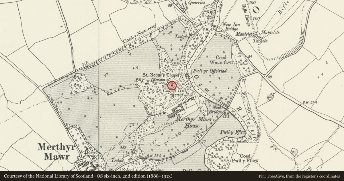
Slide toward Today to fade the historical sheet and see the modern map underneath.
David Rumsey Map Collection, Stanford LibrariesDavid Rumsey Map Collection, Stanford LibrariesDavid Rumsey Map Collection, Stanford LibrariesDavid Rumsey Map Collection, Stanford LibrariesDavid Rumsey Map Collection, Stanford Libraries
5 historical maps cover this location, the earliest the 1636 map "Cornubia : Devonia, Somersetus, Dorcestria, Wiltonia, Glocestria ..." (David Rumsey Map Collection, Stanford Libraries).
Historical maps covering this location
- 1636 · Cornubia : Devonia, Somersetus, Dorcestria, Wiltonia, Glocestria ... (David Rumsey Map Collection, Stanford Libraries)
- 1637 · The fourth table of England. Cornub. Devonia, Somerset etc. (David Rumsey Map Collection, Stanford Libraries)
- 1865 · England and Wales. England No. 6. (David Rumsey Map Collection, Stanford Libraries)
- 1897 · 262 Pontypridd (Hills) (David Rumsey Map Collection, Stanford Libraries)
- 1897 · 262 Pontypridd (Outline) (David Rumsey Map Collection, Stanford Libraries)
Cadw's description
Summary description and reason for designation
The following provides a general description of the Scheduled Ancient Monument.
The monument consists of the remains two free standing crosses probably dating to the early medieval or medieval period. The first being a cross-shaft and the second a carved cross; both now stand within the remains of St. Rogue's chapel. The cross-shaft is roughly rectangular being 1m in height, 0.5m in width and 0.2 m in depth; it is decorated on three sides with plaitwork and a worn inscription on the remaining elevation. The carved cross measures 2m in height, 1.2m in width and 0.2m in depth; the left hand side of the cross is missing. All four sides of the shaft are decorated and framed by mouldings.
The monument is of national importance for its potential to enhance our knowledge of the organisation and practice of Christianity. A cross may be part of a larger cluster of monuments and their importance can further enhanced by their group value.
The scheduled area comprises the remains as described.
Nearby in the register
- St Rogue's ChapelChapelunder 1 mi
- Chapel of St RoqueReligious, Ritual and Funeraryunder 1 mi
- Chapel Hill CampHillfortunder 1 mi
- Gate Piers to Service Court and Attached Walls at Merthyr Mawr HouseGardens, Parks and Urban Spacesunder 1 mi
Other entries of the same register within about three miles of this one, by straight line.