Cof Cymru: National Historic Assets of Wales · Wales
Twthill (Further and Additional Areas)
Rhuddlan, Denbighshire, Wales
A scheduled monument in Rhuddlan, Denbighshire, recorded as Motte and Bailey (Medieval).
The record
- Designation
- Scheduled monument
- Site type
- Motte and Bailey
- Period
- Medieval
- Date of designation
- 29 October 1962
- Community
- Rhuddlan
- Unitary authority
- Denbighshire
- Country
- Wales
- Coordinates (centre of the scheduled area)
- 53.28714, -3.46198
- SAM number
- FL015
- Cadw record number
- 3091
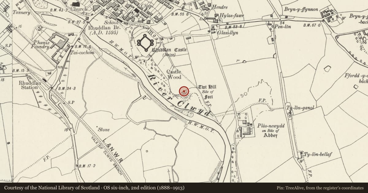
Slide toward Today to fade the historical sheet and see the modern map underneath.
David Rumsey Map Collection, Stanford LibrariesDavid Rumsey Map Collection, Stanford LibrariesNational Library of ScotlandDavid Rumsey Map Collection, Stanford LibrariesLlyfrgell Genedlaethol Cymru – The National Library of Wales
5 historical maps cover this location, the earliest the 1795 map "To Sir Watkin Williams-Wynn Bart ... the map of the six counties of North Wales is most humbly inscribed by his obedient humble servant" (Llyfrgell Genedlaethol Cymru – The National Library of Wales).
Historical maps covering this location
- 1795 · To Sir Watkin Williams-Wynn Bart ... the map of the six counties of North Wales is most… (Llyfrgell Genedlaethol Cymru – The National Library of Wales)
- 1883 · Watershed map England, Wales 3. (David Rumsey Map Collection, Stanford Libraries)
- 1898 · 95 Rhyl (Hills) (David Rumsey Map Collection, Stanford Libraries)
- 1901 · Sheet 9 and 10. (David Rumsey Map Collection, Stanford Libraries)
- 1963 · Map No. 36 - Local Government Commission for Wales : [Definitive maps showing proposed… (National Library of Scotland)
Cadw's description
Summary description and reason for designation
The following provides a description of the Scheduled Ancient Monument.
This monument comprises the remains of a medieval motte and bailey castle. Built in 1073, by Robert ‘of Rhuddlan’, the castle sits on the eastern side of the river Clwyd. For many years Rhuddlan was the lowest crossing point and highest point of navigation on the river Clwyd; this became particularly important between the 10th and 13th centuries. It could control traffic running both along and across the northern part of the Vale of Clwyd, and could be supplied by water.
The motte stands 18m high above the river, and was protected inland by a natural valley and an artificial ditch; beyond this to the north, lies the bailey. The bailey bank has been ploughed down. As late as 1241-42 the defences, at least in part, were still made of wood, and timber-framed buildings occupied the bailey.
This monument is of national importance for its potential to enhance our knowledge of medieval social, domestic and political life and warfare. The scheduled area comprises the remains described and an area around them within which related evidence may be expected to survive.
Nearby in the register
- Rhuddlan Town BanksTown Defencesunder 1 mi
- Part of Site of Norman BoroughTownunder 1 mi
- Rhuddlan CastleDefenceunder 1 mi
- Castell RhuddlanCastleunder 1 mi
Other entries of the same register within about three miles of this one, by straight line.