Cof Cymru: National Historic Assets of Wales · Wales
Cadwgan Hall Mound
Esclusham, Wrexham, Wales
A scheduled monument in Esclusham, Wrexham, recorded as Motte (Medieval).
The record
- Designation
- Scheduled monument
- Site type
- Motte
- Period
- Medieval
- Community
- Esclusham
- Unitary authority
- Wrexham
- Country
- Wales
- Coordinates (centre of the scheduled area)
- 53.03162, -3.04754
- SAM number
- DE131
- Cadw record number
- 1019
Slide toward Today to fade the historical sheet and see the modern map underneath.
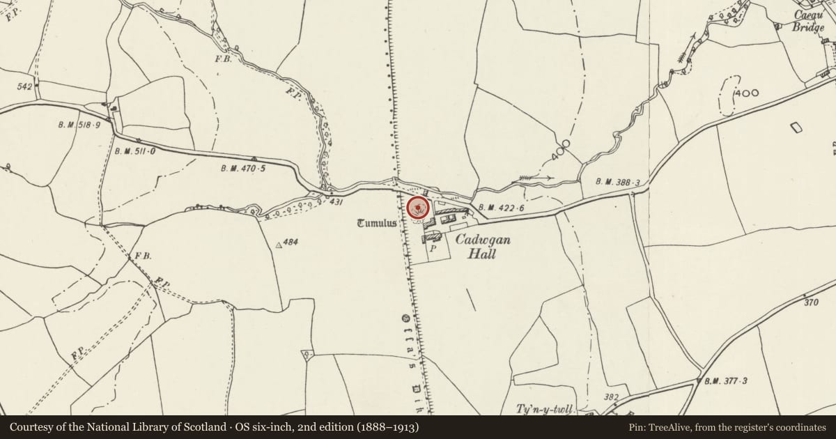
David Rumsey Map Collection, Stanford LibrariesDavid Rumsey Map Collection, Stanford LibrariesDavid Rumsey Map Collection, Stanford LibrariesDavid Rumsey Map Collection, Stanford LibrariesLlyfrgell Genedlaethol Cymru – The National Library of Wales
5 historical maps cover this location, the earliest the 1795 map "To Sir Watkin Williams-Wynn Bart ... the map of the six counties of North Wales is most humbly inscribed by his obedient humble servant" (Llyfrgell Genedlaethol Cymru – The National Library of Wales).
Historical maps covering this location
- 1795 · To Sir Watkin Williams-Wynn Bart ... the map of the six counties of North Wales is most… (Llyfrgell Genedlaethol Cymru – The National Library of Wales)
- 1883 · Watershed map England, Wales 3. (David Rumsey Map Collection, Stanford Libraries)
- 1898 · 121 Wrexham (Hills) (David Rumsey Map Collection, Stanford Libraries)
- 1898 · 121 Wrexham (Outline) (David Rumsey Map Collection, Stanford Libraries)
- 1901 · Sheet 9 and 10. (David Rumsey Map Collection, Stanford Libraries)
Cadw's description
Summary description and reason for designation
The following provides a general description of the scheduled ancient monument.
The monument comprises the remains of a motte and ditch, dating to the medieval period (c. 1066 -1540 AD). A motte is a large conical or pyramidal mound of soil and/or stone, usually surrounded by either a wet or dry ditch, and surmounted by a tower constructed of timber or stone. Cadwgan Hall mound is part natural hillock and part earthwork, situated within a small field, lying to the east of a section of Offa's Dyke (DE132). The mound is approximately 42m in diameter and 2.5m high, with the remains of an air-raid shelter cut into the north-west slope of the site. A slight hollow on its west side may be the trace of a ditch. A hoard of armour is traditionally said to have been dug out of the mound.
The monument is of national importance for its potential to enhance our knowledge of medieval defensive practices. The monument is well-preserved and an important relic of the medieval landscape. It retains significant archaeological potential, with a strong probability of the presence of both structural evidence and intact associated deposits.
The scheduled area comprises the remains described and areas around them within which related evidence may be expected to survive.
Nearby in the register
- Offa's Dyke: Cadwgan Hall Section, extending from River Clywedog to the RailwayLinear Earthworkunder 1 mi
- Offa's Dyke: Section extending 120m from Railway to Bronwylfa Road, LegacyLinear Earthworkunder 1 mi
- Barn Range at Esclusham HallAgriculture and Subsistenceunder 1 mi
- Esclusham HallDomesticunder 1 mi
Other entries of the same register within about three miles of this one, by straight line.