Cof Cymru: National Historic Assets of Wales · Wales
Pont Newydd (Northern)
Pentrefoelas, Conwy, Wales
A scheduled monument in Pentrefoelas, Conwy, recorded as Bridge (Post Medieval/Modern).
The record
- Designation
- Scheduled monument
- Site type
- Bridge
- Period
- Post Medieval/Modern
- Community
- Pentrefoelas
- Unitary authority
- Conwy
- Country
- Wales
- Coordinates (centre of the scheduled area)
- 53.04677, -3.69971
- SAM number
- DE098
- Cadw record number
- 3618
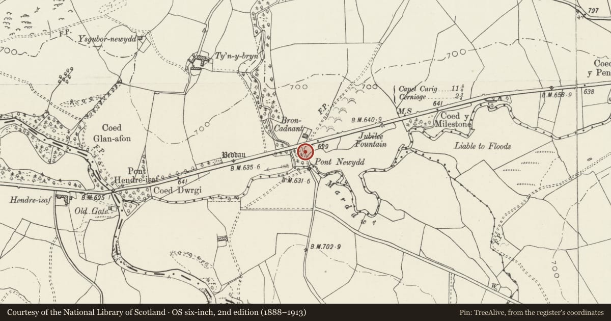
Slide toward Today to fade the historical sheet and see the modern map underneath.
David Rumsey Map Collection, Stanford LibrariesDavid Rumsey Map Collection, Stanford LibrariesDavid Rumsey Map Collection, Stanford LibrariesBayerische Staatsbibliothek, MunichLlyfrgell Genedlaethol Cymru – The National Library of Wales
5 historical maps cover this location, the earliest the 1588 map "Ortelius, Abraham: Theatro De La Tierra Universal. 0" (Bayerische Staatsbibliothek, Munich).
Historical maps covering this location
- 1588 · Ortelius, Abraham: Theatro De La Tierra Universal. 0 (Bayerische Staatsbibliothek, Munich)
- 1608 · (13) Cambriae Typus. (David Rumsey Map Collection, Stanford Libraries)
- 1795 · To Sir Watkin Williams-Wynn Bart ... the map of the six counties of North Wales is most… (Llyfrgell Genedlaethol Cymru – The National Library of Wales)
- 1898 · 120 Corwen (Hills) (David Rumsey Map Collection, Stanford Libraries)
- 1901 · Sheet 9 and 10. (David Rumsey Map Collection, Stanford Libraries)
Cadw's description
Summary description and reason for designation
The following provides a general description of the Scheduled Monument.
A roughly coursed post-medieval, rubble-built, single span bridge. A hemispherical arch, with modern concrete carriageway and kerb with iron railings cantilevered 0.3m out beyond the underlying structure. A single rubble arch-ring and inset rubble-voussoired arch crosses a small pool collecting drainage from the meadow to the east and a few metres upstream of the junction of Afonydd Cadnant and Merddwr. It is sited immediately S of the A5 road on the approach road from Bron Cadnant to Ty'n Llwyn.
The monument is of national importance for its potential to enhance our knowledge of post-medieval construction and transport. It retains significant archaeological potential, with a strong probability of the presence of associated archaeological features and deposits. The structure itself may be expected to contain archaeological information concerning chronology and building techniques.
The scheduled area comprises the remains described and areas around them within which related evidence may be expected to survive.
Nearby in the register
- Causeway with two bridges at Pont Newydd (partly in Ysbyty Ifan community)Transportunder 1 mi
- Holyhead Road Bridge at Bron-cadnantTransportunder 1 mi
- Pont Newydd (Southern)Bridgeunder 1 mi
- Causeway with two bridges at Pont Newydd (partly in Pentrefoelas community)Transportunder 1 mi
Other entries of the same register within about three miles of this one, by straight line.