Cof Cymru: National Historic Assets of Wales · Wales
New Foxhall House
Henllan, Denbighshire, Wales
A scheduled monument in Henllan, Denbighshire, recorded as House (domestic) (Post Medieval/Modern).
The record
- Designation
- Scheduled monument
- Site type
- House (domestic)
- Period
- Post Medieval/Modern
- Community
- Henllan
- Unitary authority
- Denbighshire
- Country
- Wales
- Coordinates (centre of the scheduled area)
- 53.19579, -3.45370
- SAM number
- DE054
- Cadw record number
- 385
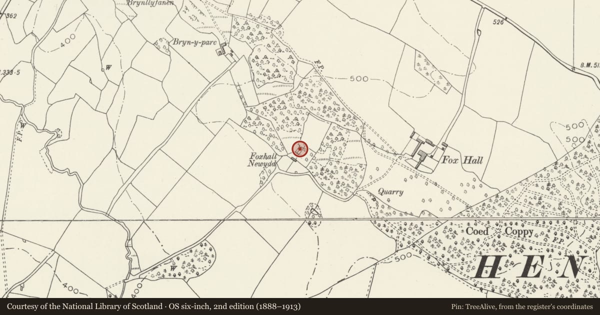
Slide toward Today to fade the historical sheet and see the modern map underneath.
David Rumsey Map Collection, Stanford LibrariesDavid Rumsey Map Collection, Stanford LibrariesBayerische Staatsbibliothek, MunichLlyfrgell Genedlaethol Cymru – The National Library of WalesDavid Rumsey Map Collection, Stanford Libraries
5 historical maps cover this location, the earliest the 1588 map "Ortelius, Abraham: Theatro De La Tierra Universal. 0" (Bayerische Staatsbibliothek, Munich).
Historical maps covering this location
- 1588 · Ortelius, Abraham: Theatro De La Tierra Universal. 0 (Bayerische Staatsbibliothek, Munich)
- 1608 · (13) Cambriae Typus. (David Rumsey Map Collection, Stanford Libraries)
- 1795 · To Sir Watkin Williams-Wynn Bart ... the map of the six counties of North Wales is most… (Llyfrgell Genedlaethol Cymru – The National Library of Wales)
- 1883 · Watershed map England, Wales 3. (David Rumsey Map Collection, Stanford Libraries)
- 1901 · Sheet 9 and 10. (David Rumsey Map Collection, Stanford Libraries)
Cadw's description
Summary description and reason for designation
The monument consists of the remains of a late sixteenth/early seventeenth century house. Foxhall Newydd was begun in 1592 by John Panton, but the house was never completed. It was a 3 storey stone-building with attic and basement, but is now a ruinous shell, with walling to almost full height, but without roofs or floors. It has a long cruciform plan with a short central stair projection opposite a entrance projection. There are projecting lateral fireplaces to each side, stone mullion windows with internal voussoirs, two full height bay-windows and a gabled-dormer roof line.
The monument is of national importance for its potential to enhance our knowledge of settlement and domestic activity. It retains significant archaeological potential, with a strong probability of the presence of associated archaeological features and deposits. The structure itself may be expected to contain archaeological information concerning chronology and building techniques. A house may be part of a larger cluster of monuments and their importance can further enhanced by their group value.
The scheduled area comprises the remains described and areas around them within which related evidence may be expected to survive.
Nearby in the register
- Foxhall NewyddDomesticunder 1 mi
- Former Domestic Range adjoining Foxhall Newydd ruins to the SWDomesticunder 1 mi
- Dovecote at Foxhall Newydd including adjoining WallsDomesticunder 1 mi
- New Foxhall Dovecotdovecoteunder 1 mi
Other entries of the same register within about three miles of this one, by straight line.