Cof Cymru: National Historic Assets of Wales · Wales
Six Inscribed Stones in St Tudclud's Church, Penmachno
Bro Machno, Conwy, Wales
A scheduled monument in Bro Machno, Conwy, recorded as Inscribed Stone (Early Medieval).
The record
- Designation
- Scheduled monument
- Site type
- Inscribed Stone
- Period
- Early Medieval
- Community
- Bro Machno
- Unitary authority
- Conwy
- Country
- Wales
- Coordinates (centre of the scheduled area)
- 53.03885, -3.80620
- SAM number
- CN182
- Cadw record number
- 209
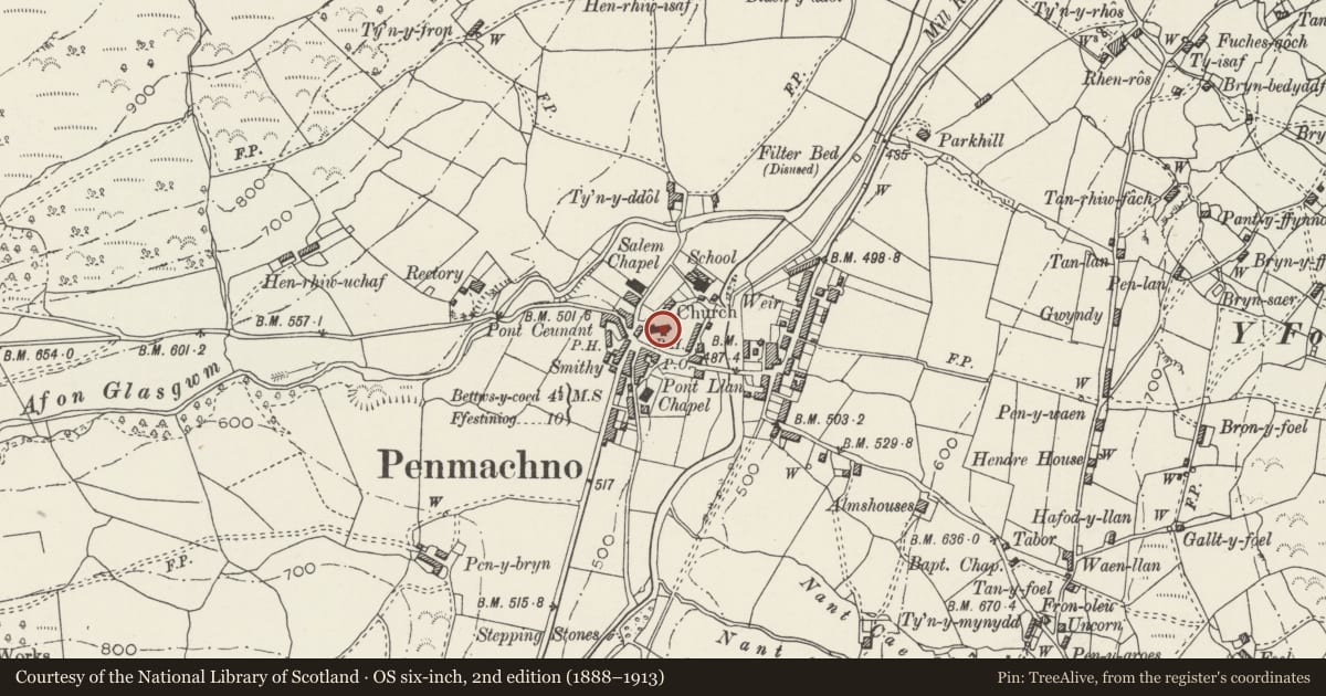
Slide toward Today to fade the historical sheet and see the modern map underneath.
David Rumsey Map Collection, Stanford LibrariesDavid Rumsey Map Collection, Stanford LibrariesLlyfrgell Genedlaethol Cymru – The National Library of WalesDavid Rumsey Map Collection, Stanford LibrariesDavid Rumsey Map Collection, Stanford Libraries
5 historical maps cover this location, the earliest the 1795 map "To Sir Watkin Williams-Wynn Bart ... the map of the six counties of North Wales is most humbly inscribed by his obedient humble servant" (Llyfrgell Genedlaethol Cymru – The National Library of Wales).
Historical maps covering this location
- 1795 · To Sir Watkin Williams-Wynn Bart ... the map of the six counties of North Wales is most… (Llyfrgell Genedlaethol Cymru – The National Library of Wales)
- 1830 · V.3:11-15:XV. Britisches Reich. A. Kon: England. b. Frstenthum Wales: Shire: 37-40 (David Rumsey Map Collection, Stanford Libraries)
- 1883 · Watershed map England, Wales 3. (David Rumsey Map Collection, Stanford Libraries)
- 1899 · 119 Snowdon (Hills) (David Rumsey Map Collection, Stanford Libraries)
- 1901 · Sheet 9 and 10. (David Rumsey Map Collection, Stanford Libraries)
Cadw's description
Summary description and reason for designation
The following provides a general description of the Scheduled Ancient Monument.
Six inscribed stones in Penmachno church, four are hung on or mounted at the base of the N chancel wall and two are hung on the N wall of the nave.
Archaeological Item # CN182A
A rough pillar stone 72cm long by 30cm wide. There is a Latin inscription in five horizontal lines, preceded by the Chi-Rho monogram. The inscription reads CARAUSIUS/HIC IACIT/IN HOC CON/GERIES LA/PIDUM.
Now situated on N wall of chancel of Penmachno church.
Archaeological Item # CN182B
A rough pillar stone 114cm long by 18cm wide. There is a fragmentary Latin inscription in one line reading vertically downwards. The inscription reads ]ORIA (h)IC IACIT.
Now situated at base of N wall of chancel of Penmachno church.
Archaeological Item # CN182C
A rough pillar stone 89cm long by 25cm wide. There is a Latin inscription in five lines (three on the main face, two on left edge) reading vertically downwards: CANTIORI(x) HIC IACIT/[V]ENEDOTIS CIVE(s) FVIT/[C]ONSOBRINO(s)/MA[G]LI/MAGISTRAT-.
Now situated at base of N wall of chancel of Penmachno church.
Archaeological Item # CN182D
A rough pillar stone 102cm long by 24cm wide. There is a Latin inscription in four lines, one reading vertically downwards, the others horizontally across the bottom. ]FILI AVAITORI//IN TE(m)PO[RE]/ IVSTI[NI]/CON[SULI(s)].
Now situated at base of N wall of chancel of Penmachno church.
Archaeological Item # CN182E
A rough pillar stone 120cm long by 18cm wide. Decorated with a rudely incised equal-armed cross.
Now situated on N wall of nave of Penmachno church.
Archaeological Item # CN182F
A stone slab grave cover with the top broken off 1.45m long and 0.34m wide. Decorated with an incised cross on a three-stepped base.
Now situated on N wall of nave of Penmachno church.
The monument is of national importance for its potential to enhance our knowledge of Early Medieval Inscribed Stones. They retain significant archaeological potential.
The scheduled area comprises the remains described.
Nearby in the register
- Parish Church of St TudcludReligious, Ritual and Funeraryunder 1 mi
- 3 Church ViewDomesticunder 1 mi
- 2 Church ViewDomesticunder 1 mi
- 1 Church ViewDomesticunder 1 mi
Other entries of the same register within about three miles of this one, by straight line.